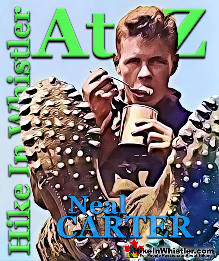
![]() Neal Carter (14 Dec 1902 – 15 Mar 1978) was a mountaineer and early explorer of the Coast Mountains primarily in the 1920’s and 1930’s. Astoundingly skilled as a mountaineer, Carter also excelled at cartography and surveying which he used to map the vast unnamed and unexplored mountains of BC. He named a staggering number of mountains and alpine features, as well as making at least 25 first ascents, many around what we now call the Whistler Valley.
Neal Carter (14 Dec 1902 – 15 Mar 1978) was a mountaineer and early explorer of the Coast Mountains primarily in the 1920’s and 1930’s. Astoundingly skilled as a mountaineer, Carter also excelled at cartography and surveying which he used to map the vast unnamed and unexplored mountains of BC. He named a staggering number of mountains and alpine features, as well as making at least 25 first ascents, many around what we now call the Whistler Valley.
Neal Carter Mountaineer
- Neal Carter Mountaineering Highlights
- First Ascents by Neal Carter
- 1920: Black Tusk North Pinnacle
- 1922: Second Ascent of The Table
- 1923: Wedge & Whistler Expedition
- 1924: Climbing in the Tantalus Range
- 1925: Fighting Way to Mt. Tantalus
- 1932: Mount Meager Expedition
- 1933: To the Cradle of Toba River!
- 1934: Mount Waddington Tragedy
Carter recalled what he thought of the valley when he saw it for the first time in 1923.
“..the skylines seen from their main valley in which Alpha, Nita, Alta, and Green Lakes lie. Alpine features beyond those skylines were pretty sketchy on maps, and few had names.”
A few weeks later he and Charles Townsend would spend two weeks exploring these mountains, nearly all unclimbed, unnamed and very challenging. A skilled mountaineer, surveyor and cartographer, he compiled much of the data that went into the first official topographic map of Garibaldi Park in 1928. Karl Ricker, legendary Whistler mountaineer responsible for the now celebrated Spearhead Traverse, later described Carter's extraordinary work that went into the original Garibaldi Park map.
"...in 1926 the production of the first topographical map of the Garibaldi Lake area. Its construction was a marvel of ingenuity. Painstakingly, he measured two short baselines at either end of the lake; from the ends of both, as well as from several summits, he took great pains to level a simple camera for the necessary panoramic photos. Elaborate calculation from the angles measured on these photos provided the data needed to construct a topo map with 250 foot contour intervals at a scale of on half mile to the inch. Almost all of the calculated peak elevations proved to be within 50 feet or less of the more recently established heights, and the map compares quite favourably, contour-wise, with the 1928 and all subsequent government maps of the area."
Neal Carter was the driving force in massively increasing the size of Garibaldi Park to include the Spearhead Range and the mountains beyond Wedge Mountain. He photographed his hiking expeditions and compiled several hiking albums, three of which have only recently found their way to the MONOVA Museum in Vancouver. The Whistler Museum also has a considerable collection of photos Carter gave to Myrtle Philip at Rainbow Lodge, where he stayed during his amazing two weeks of exploring in 1923. Carter also wrote several wonderful newspaper articles about his fascinating expeditions into the vast and largely unknown Coast Mountains.
Wedge & Whistler Expedition in 1923

These are some of the photos Neal Carter gave to Myrtle Philip, which now are at the Whistler Museum. The picture on the far left is of Charles Townsend standing on a cliff near the summit of Mount James Turner on September 12th 1923. The second picture shows Townsend standing next to the cairn they built on the summit of Wedge Mountain, two days previously, with Mount James Turner visible in the distance. The third picture is of Neal Carter eating out of a can during the expedition, possibly on Whistler Mountain, though the exact date and location is not known. On the far right is Neal Carter on the summit ridge of Wedge Mountain on September 10th, 1923.
Neal Carter's Introduction to Mountaineering
Carter began climbing the mountains around Vancouver as a teenager and at the age of seventeen he met someone who would change his life forever. In 1920, while hiking with high school friends between Grouse Mountain and Crown Mountain, Carter had a chance encounter with Tom Fyles, arguably the greatest mountaineer of the era. Fyles, a member of the BC Mountaineering Club in Vancouver, introduced him to the club which he immediately joined. Right from the start he was climbing regularly with Fyles and other elite BC mountaineers. 1920 was also the year Carter began studying Chemical Engineering at the University of British Columbia. He would go on to graduate with a B.A.Sc in Chemical Engineering in 1925 and M.A. in 1926. From 1926 to 1929 he studied at McGill University in Montreal where he earned a PhD in Organic Chemistry. The following year he attended the Kaiser Wilhelm Institute in Dresden, Germany doing post doctoral research. He returned to Canada in 1930 and began his career as a marine biologist in fisheries research.
Neal Carter in 1920 & 1921
These photos are from one of Neal Carter's beautiful photo albums that now reside at the MONOVA Museum in Vancouver. The picture on the left with Tom Fyles waving and Neal Carter standing was taken on July 4th, 1920 on The Camel's Head. The middle picture is of Neal Carter on the summit of Mount Baker in September of 1920.

The picture on the right is Carter and a friend with a caption in his album which reads, "OUR WEAPONS FOR THE CONQUEST." The photo is on a page of photos of Carter's Mt. Garibaldi trip he did in the spring of 1921 with Tom Fyles, Celmer Ross and H. J. Graves. This very ambitious and challenging trek covered a considerable distance over mostly snow covered terrain and was the first known springtime ascent of Mount Garibaldi.
Novice to Expert Mountaineer in 1920
Neal Carter's mountaineering activity began at a frenzied pace in 1920 after he joined the BC Mountaineering Club. Several Vancouver area mountains were climbed early in the year such as Cathedral, Goat, Seymour, Grouse, The Lions, Crown Mountain, The Camel's Head, and many more. In the summer the BCMC had their summer camp in Black Tusk meadows and was Carter's first introduction to the newly established Garibaldi Park. Tom Fyles led a large group up Black Tusk, most in the group, including Carter, for the first time. From the broad sloping top of Black Tusk, Fyles decided to make an attempt on the North Pinnacle of Black Tusk. Carter and another young climber, Bill Wheatley joined him and the trio recorded the first known ascent of the true summit of Black Tusk.
Neal Carter's Mountaineering Album at the MONOVA Museum

The following year, in 1921 Carter would join Tom Fyles and Don Munday on a first ascent of the north ridge of Grizzly Mountain. In 1922 another four first ascents were made and two of them, The Bookworms and Deception Peak would also be named by Carter. In 1923 Carter and Charles Townsend went on their incredible two-week expedition into the mountains around the future site of Whistler. Several first ascents were made and unnamed mountains and peaks were named. In 1924 Carter would lead his second springtime expedition into the little explored Tantalus Range. From various summits Carter named several of the unnamed mountains in the range which later became official. In the summer of 1924 he led the BCMC summer camp in the Fitzsimmons Valley and the group made the first ascent of another unnamed mountain, which Carter named Mount Fitzsimmons. In 1925 Carter went on his third springtime expedition in the Tantalus Range in his second attempt to reach the summit of Mount Tantalus.
1925 Tantalus Expedition

In 1926, 1929 and 1932 Neal Carter made three more first ascents, Luxor Mountain, Mount Davidson and Grimface Mountain. In 1932 and 1933 Carter, Tom Fyles, Mills Winram and Alec Dalgleish went on two amazing expeditions, the first to Mount Meager and the second to the headwaters of Toba River. Several first ascents were made on the Meager expedition and many unnamed peaks were named. The Toba expedition was much more remote and difficult and only one first ascent was accomplished. In 1934, Carter and Dalgleish embarked on another, far more difficult and remote expedition with two other expert mountaineers to attempt a first ascent on Mount Waddington. The attempt would end in tragedy however, when Dalgleish fell to his death on a roped decent.
In the early 1940's Carter surveyed the Seven Sisters Range near Smithers, and was the first to climb the highest peak, Mt. Weeskinisht. He remained an active climber in the 1950's with two important first ascents, Mount Monmouth in 1951 and Mount Gilbert in 1954. While his contributions to climbing and surveying are not widely known, he is certainly one of the greatest British Columbia mountaineers. Mount Neal, located near Wedge Mountain in Garibaldi Park, which he also played a key part in lobbying to expand its borders to their current size, has been named for him, though he yet to climb it. In 1967 he finally climbed it and retraced much of the terrain he hiked in 1923 with Charles Townsend on their expedition to make the first ascent of Wedge Mountain. Karl Ricker wrote about it in the VOC Journal.
"...in 1967 he finally climbed his namesake - Mt. Neal as a long and overdue second ascent. Some V.O.C.ers had "scooped" him with the first ascent in 1950. He and his wife walked back out to the road after that latest episode by way of Wedge Pass."
Carter was made an honorary member of the Alpine Club of Canada in 1974, and for his mapping work, he was named a Fellow of the Royal Geographical Society. He died in 1978 while diving in Barbados at the age of 75.
Neal Carter Mountaineering Highlights
 1920: Black Tusk North Pinnacle
Neal Carter’s impressive mountaineering feats began at an astounding pace. In 1920, Tom Fyles, Neal Carter and Bill Wheatley made the first known ascent of the north peak of Black Tusk. Slightly higher and just a few metres from main summit, known officially as the true summit. This terrifying feat involved climbing down the crumbling edge of Black Tusk into a gully and up the north pinnacle. Surrounding the pinnacle is a vertical drop of hundreds of metres and most of the surface rock is fractured and finding a solid handhold to climb is difficult. Likely a spur of the moment idea by Tom Fyles, who had the extraordinary ability to climb anything and was absolutely fearless. Continued here...
 1922: The Table Second Ascent
In 1922, Neal Carter, Tom Fyles and Bill Wheatley successfully climbed The Table, a mountain so difficult and dangerous that even today, few have climbed it. Theirs was only the second recorded ascent of The Table, with Tom Fyles making the first ascent in 1916. The Table is a crumbling, flat topped mountain that formed as a volcano pushing its way to the surface of a glacier. Located across Garibaldi Lake from Black Tusk, The Table is similarly crumbling and its steep sides make it incredibly hard to climb. In 1922, Fyles reached the top once again and Carter and Wheatley followed with help from Fyles’ rope from the summit. Continued here...
 1923: Wedge & Whistler Expedition
In the summer of 1923 Neal Carter and Charles Townsend went on an incredible two-week climbing expedition around what is now Whistler. They set off from Rainbow Lodge and climbed the previously unclimbed Wedge Mountain. From the summit of Wedge they spotted a mountain to the north in the midst of a maze of glaciers. They named it Mount James Turner and managed its first ascent as well. In the following days they hiked up Singing Pass and to the summit of Overlord Mountain. They made first ascents of two peaks, which they named Diavolo and Whirlwind. Carter left photos at Rainbow Lodge and now they reside in Whistler Museum. Continued here...
 1924: Climbing in the Tantalus Range
In the spring of 1924 Neal Carter set out on his second expedition into the Tantalus Range with Hazen Nunn, Ted Taylor, Art Cooper and Fred Smith. Mount Tantalus was their main goal, however, deep springtime snow, bad weather and difficult route finding barred their attempt. Despite not reaching the summit of Tantalus, the expedition reached the summits of several other prominent mountain peaks, such as Alpha, Pelops, Dione and Omega. Along the way they named several unnamed mountains in keeping with the Greek myth of Tantalus. Niobe, Pelops, Dione, Sisyphus and Pandareus are all names created by Neal Carter on this remarkable expedition in 1924. Carter's beautiful photo album of the expedition is now at the MONOVA Museum in Vancouver. Continued here...

1925: Fighting Way to Mt. Tantalus
Neal Carter’s third expedition into the Tantalus Range was with Charles Townsend and Hazen Nunn. This time the trio of expert mountaineers set out to finally reach the summit of Tantalus. They battled through brutally steep, difficult and dangerous terrain over glaciers and terrifying ridges. With just a couple hundred metres from the summit the knife edge, snow covered ridge gave way to a deep chasm, too dangerous to cross. Despite the unsuccessful attempt, the expedition was later written about by Carter in a thrilling article in the Vancouver Sunday Province, along with some amazing photos taken along the way. Carter also created a wonderful photo album of the expedition which now resides in the MONOVA Museum in Vancouver. Continued here...
 1932: Meager Expedition
August 8th-20th, 1932 Neal Carter, Tom Fyles, Mills Winram and Alec Dalgleish went on a spectacular mountaineering expedition up the headwaters of Lillooet River to Mount Meager. On day 5 Carter recalled, "the toe of a likely looking ridge at an elevation of 1750 feet opposite some hot springs on the bank of the creek was reached." The hot springs they saw are now well known as Meager Hot Springs. In the following days they climbed all six of the volcanic peaks of the Mount Meager massif and named the five unnamed ones. Mount Job, Capricorn Mountain, Devastator Peak, Plinth Peak and Pylon Peak were named. Beyond Meager, unknown peaks stretched to the ocean and another expedition was planned. Continued here...
 1933: Toba Expedition
The unknown mountains they saw from Mount Meager in 1932 were located at the headwaters of Toba River, which drained into Toba Inlet far up the coast of BC. In 1933, Neal Carter, Tom Fyles, Mills Winram and Alec Dalgleish teamed up again to explore this vast unknown. The remote Toba Inlet was reached by boat and the expedition involved boating upriver for several miles, then hiking great distances through near impenetrable forest. Despite weathering brutal terrain, considerable bushwhacking, and dangerous river crossings, they managed to make the first ascent of a towering and forbidding mountain they named Mount Julian. Continued here...
 1934: Waddington Tragedy
After the Toba Expedition, Alec Dalgleish set his sights on what was the greatest mountaineering prize of the era, the still unclimbed Mount Waddington. The highest peak in the Coast Mountains and requiring a journey of several days to get to. Neal Carter and Eric Brooks joined this brutally challenging expedition to this remote mountain in 1934. The remoteness and difficulty of Waddington was vastly more than the Toba Expedition. The assault on Mount Waddington would end in tragedy however, when Alec Dalgleish fell to his death while on a roped descent along a smooth, outwardly sloping ledge. His belaying rope did not save him as it was cut by the sharp edge of a frost-shattered rock. His body could not be recovered. Continued here...
First Ascents by Neal Carter
- 1920 Black Tusk north peak, true summit first ascent with Tom Fyles and Bill Wheatley.
- 1921 Grizzly Mountain north ridge first ascent with Tom Fyles and Don Munday.
- 1922 Isosceles Peak first ascent with Don & Phyllis Munday, Harold O’Connor and Clausen Thompson.
- 1922 Parapet Peak first ascent with Don & Phyllis Munday, Harold O’Connor and Clausen Thompson.
- 1922 The Bookworms first ascent and named with Charles Townsend.
- 1922 Deception Peak first ascent and named with Charles Townsend.
- 1923 Wedge Mountain first ascent with Charles Townsend.
- 1923 Mount James Turner first ascent and named with Charles Townsend.
- 1923 Whirlwind Peak first ascent and named with Charles Townsend.
- 1923 Diavolo Peak first ascent and named with Charles Townsend.
- 1924 Angelo Peak first ascent with BCMC party previously named by Neal Carter and Charles Townsend.
- 1924 Mount Fitzsimmons first ascent with BCMC party and named by Neal Carter.
- 1926 Luxor Mountain first ascent with Peggy Carter, H. Angus, Neil Hossie, B. Martin and W. Martin.
- 1929 Mount Davidson first ascent with Emmy Milledge.
- 1932 Grimface Mountain first ascent and named with Peggy Carter.
- 1932 Capricorn Mountain first ascent and named with Tom Fyles, Alec Dalgleish and Mills Winram.
- 1932 Mount Meager first ascent with Tom Fyles, Alec Dalgleish and Mills Winram.
- 1932 Plinth Peak first ascent and named with Tom Fyles, Alec Dalgleish and Mills Winram.
- 1932 Pylon Peak first ascent and named with Tom Fyles, Alec Dalgleish and Mills Winram.
- 1932 Devastator Peak first ascent and named with Tom Fyles, Alec Dalgleish and Mills Winram.
- 1932 Mount Job first ascent and named with Tom Fyles, Alec Dalgleish and Mills Winram.
- 1933 Mount Dalgleish first ascent with Tom Fyles, Alec Dalgleish and Mills Winram.
- 1941 Weeskinisht Peak (Seven Sisters Mountain) first ascent with K. Carter, G. Baker and J. Cade.
- 1951 Monmouth Mountain first ascent with A. Melville, I. Kay, T. Marston, D. Blair, W. Sparling and H. Genschorek.
- 1954 Mount Gilbert first ascent with E. Pigou. L. Blumer; A. Melville; P. Sherman; D. Young and J. Young.
1920: Black Tusk North Pinnacle
Tom Fyles, Neal Carter & Bill Wheatley
The August 17th, 1920 edition of the Vancouver Sun newspaper ran a story titled, "Garibaldi Park Is Formally Opened by Local Mountaineers”. The article details several peaks climbed over the two weeks and described their climb of Black Tusk with interesting detail. “Several good climbs were made from the camp last week, one of the most ambitious being the ascent of Black Tusk, a huge basalt rock that projects out of the top of the mountain over 7,000 feet in the air like the horn of a giant rhinoceros.” The article goes on the describe how Black Tusk formed from the plug of an ancient volcano and the only way to climb to the top is done, “by climbing over the projecting rim of a funnel which a lightening bolt has cut in the rock.” This interesting observation is strange and the article doesn’t mention where that theory came from, or how lightening could carve out a huge gouge in a mountain. The article also mentions another strange and improbable incident involving lightening. “One of the treasured trophies in the cairn is an ancient tobacco tin which held the record in the previous cairn. A lightening bolt a few years ago shattered the cairn, blew three feet off the face of Tusk, bored diagonally clean through the tobacco tin, burning the record and dashing the tin a hundred feet away. The present receptacle for the scroll is a common glass “sealer” inside the cairn.” Both of these lightening stories seem hard to believe, and probably made up, but the article does describe another event on Black Tusk that day that is certainly true. The first known ascent of Black Tusk's north pinnacle, the true summit by Tom Fyles, Neal Carter and Bill Wheatley.
Black Tusk's North Pinnacle Far Away and Up Close

Black Tusk's True Summit
The top of Black Tusk is quite broad, large, flat and slopes down toward the chimney route up. At the opposite end is the high point of Black Tusk and the final destination for everyone that climbs it. Technically this point is not the true summit of Black Tusk. Another, slightly higher pinnacle rises just a few metres from the top edge. This narrow, crumbling pinnacle of rock has a very small area at its peak and getting to it requires climbing down the frightening, vertical edge of Black Tusk and descending into the deep gully between the two peaks and climbing up the near vertical, crumbling side of the narrow pinnacle. Terrifying, dangerous, very difficult, and almost certainly unclimbed, Tom Fyles had to climb it. Fearless and an astoundingly skilled climber, in 1916 Fyles had climbed The Table, a similarly crumbling, yet vastly larger and more challenging mountain. By comparison, this tiny ascent must have looked to Fyles as a short and simple climb, which to an astoundingly skilled climber like him, it was. From the top of the crumbling pinnacle and true summit of Black Tusk, Fyles was soon joined by Neal Carter and Bill Wheatley, with the encouraging help of Fyles’ rope. Years later Carter would recall, “I had shown signs of mountain madness even during my first trip into Garibaldi (1920) when I helped build that little cairn on that rotten bit of the Black Tusk that sticks up (a foot or so higher than the main peak) to the west.” These two photos are from one of Neal Carter's climbing albums on exhibit at MONOVA Museum in Vancouver.
Neal Carter North Pinnacle Ascent - 11 Aug 1920

1922: Second Ascent of The Table
Tom Fyles, Neal Carter & Bill Wheatley
In 1922 Neal Carter, Tom Fyles and Bill Wheatley made the second recorded ascent of The Table. It is hard to appreciate the extraordinary difficulty of this accomplishment. Climbing The Table involves several terrifying vertical ascents up walls of crumbling rock which dislodge frequently and rain down on climbers below. Thirty-seven years later, in 1959 Neal Carter wrote a letter to Karl Ricker, in which he briefly mentioned the remarkable day.
“I was on the second ascent (again in 1922 - I must have been crazy that year). That's one mountain that I never want to climb again! The only consolation was that it was in the fog, so we couldn't see how far the drop below us was as we three clung to the loose chunks of rock that kept threatening to pull out of the sheer wall.”
The Table and Mount Garibaldi

Pictured below is the start of the successful 1922 ascent of The Table with Tom Fyles on the left, Bill Wheatley top middle and Neal Carter bottom right with the famous rope around his neck that remained fixed for a decade. The fourth person in the picture on the lower left is Joseph T. Hazard, an expert mountaineer and writer from Seattle. In his 1948 book Pacific Crest Trails, Hazard recalls a hilarious comment made by Tom Fyles poking fun at him, likely at the time this photo was taken. "You are too heavy, Hazard, to make The Table. You can climb anything that will hold you--but The Table will not. It will scale off under you and drop you into oblivion! Don't try it."
Fyles, Hazard, Wheatley & Carter The Table - 19 Aug 1922

"Top of Table Mountain is Reached"
In an article written for The Province newspaper shortly after the 1922 ascent, Neal Carter wrote about the treacherous climb in detail. Recalling how after the first ascent in 1916. “Mr. Fyles, pronounced it so rotten and loose as to warrant the name of an unjustifiable hazard; in 1920 he made two attempts to re-ascend it, but failed. This time we started off with 180 feet of alpine rope and the slogan “Table or bust.” We nearly “bust.”" Neal Carter then continues the story in beautifully vivid detail.
The weather was most unpropitious and soon after commencing the ascent, rain began to fall. Tom Fyles went up first, with a rope about his waist, and all went well up to the first little pinnacle. Here it was deemed advisable to continue up the arête at the low end; said arête being about as solid as a child’s house of blocks. Sixty feet of rope brought the party to the next stopping place, a little dip in the sharp arête that made a niche just big enough for two of us while Tom continued the ascent with 120 feet of rope dragging behind him. Shower after shower of rock whizzed past our heads as we sat almost motionless for fifty-five minutes during which only 110 feet were gained. Finally, a dim shout was heard: “All right,” and our stiffened bodies were given a chance to exercise themselves on a slanting traverse of a precipitous rock-face composed of the shakiest material imaginable. Fully half a ton of rocks were unavoidably dislodged during the ascent and descent; and did not add much to the confidence of the climbers as they went singing past in the fog to fall uninterrupted on the scree slopes below.
As the rope was followed upward in the fog, it finally landed us beside Mr. Fyles in another niche on a level with the summit, but connected to it by about twenty-five feet of wobbly, knife-edged ridge. One of these rocks was partially demolished to enable us to grip a reasonably firm rock as we straddled along it. Once the summit was reached, it was like stepping on to a macadamized field. We built a good-sized cairn on the edge in plain view from below, and placed our own as well as Mr. Fyles’ previous record in a subsidiary cairn beside it, around which were transplanted a few erigeron, or mountain daisies. Several meanings may be taken from this as to our feelings towards the descent; however, camp was reached again at 7 o’clock and The Table was conquered for the second time after a five and a half hour climb of 240 feet and back, though 120 feet of rope remain attached to the top as a mute token of a guaranteed safe descent for all three of us. It may be some time before another name is added to the three already in the cairn.
Tom Fyles & Neal Carter The Table - 19 Aug 1922

1923: Wedge & Whistler Expedition
Neal Carter & Charles Townsend
In the summer of 1923 Neal Carter was working as a surveyor in the valley stretching from Brandywine Falls to Green Lake. This valley wouldn’t be known as Whistler Valley for several more decades. Carter helped cut the first packhorse trail to Cheakamus Lake and hiked up to Whistler Mountain via Singing Pass in order to sketch the shape of Cheakamus Lake. From high up on Whistler Mountain he got a close look at Wedge Mountain, which Alex Philip would later tell him was thought to be unclimbed. Alex Philip was, along with his wife Myrtle Philip, the owners of Rainbow Lodge at Alta Lake. Alex Philip further mentioned that he believed Wedge Mountain to be a higher mountain than Mount Garibaldi. In 1923 Mount Garibaldi was the highest mountain in Garibaldi Park, which at the time extended only as far north as Cheakamus Lake. At the end of the summer with his survey work finished he persuaded Charles Townsend to join him on a two week expedition to climb Wedge Mountain and the mountains beyond.
Neal Carter's Article in The Vancouver Sun - 30 Sept 1923
Neal Carter wrote a wonderful article about his two weeks exploring the mostly unclimbed and unnamed mountains around Alta Lake, decades before it became known as Whistler Valley. His article is shown further below in bold. Dates have been added as well as photos he took that were included in this article and several other photos that were not. Some of the original black and white photos have been colourized to enhance their appearance. Wedgemount Creek mentioned several times in the article is now officially named Wedge Creek. Turner Glacier has also been officially renamed as Chaos Glacier.

RUGGED PEAKS ARE CONQUERED IN BC WILDS
By NEAL M. CARTER
While engaged on a survey along the P.G.E. Railway this summer, during which the district between Alpha and Green Lakes, and later, Cheakamus Lake, was traversed, I had occasion to view many fine unclimbed mountain peaks in the unmapped and practically unexplored regions around the heads of the valleys lying to east of the railway, and at the head of Cheakamus Lake. Chief among these was a fine peak well known to visitors at Rainbow Lodge as “Wedge Mountain” from its characteristic shape as viewed from that angle. Looking up Fitzsimmons Creek valley from a few hundred yards beyond the lodge on the railway, another high series of mountains may be seen, the highest of which was climbed this summer by Mr. and Mrs. Don Munday of the BC Mountaineering club while reconnoitring from a proposed site for a summer mountaineering camp. Having to be content while surveying with viewing these peaks from the depths of valleys, I determined to return with a fellow member of the Mountaineering club to investigate them at closer range during a two weeks pleasure trip.
FULLY EQUIPPED
With the main object of making the first climb recorded of Wedge Mountain, Mr. Charles T. Townsend and myself left Vancouver on Saturday morning, September 8, with full equipment to contend with any glacial or rock features we should encounter. This included heavily nailed boots, ice-axes, snow glasses, a rope, etc., as well as an aneroid and mapping facilities to bring back data of our trip. Food, clothing and a tent were chosen such as would keep the backpacking within the limits of a “pleasure” trip. Arriving at Alta Lake, we were in time to have our last civilized meal at Rainbow Lodge before turning in a little way up the track under the stars.
September 9,1923: Alta Lake to Camp #1 on Parkhurst Mountain
Sunday dawned a beautifully clear day, and by 10:30am we had hiked down the track to Mile 42 on Green Lake. Opposite here, a ridge comes down from the shoulder of Wedge around the base of which Wedgemount Creek wends its way through box canyons to join the Green River farther down the railway. So, turning our faces to the east, we struck into the timber and after a brief lunch of hard tack, chocolate and cheese, crossed Wedgemount Creek on a slippery log and commenced the real climbing.
Neal Carter Crossing Wedge Creek - 9 Sept 1923

OBSTACLES ENCOUNTERED
All through the hot afternoon, a tiresome series of hollows, ridges and rocky bluffs was encountered; sometimes treading on a mossy carpet, no pushing our way through dense tangles of blueberry bushes, then perhaps scrambling up some stony cliff. Without so much as a glimpse of our mountain all the way, and only one drink of water, we were heartily glad to come out at timberline about 6 o’clock and find ourselves withing an easy day’s journey of the peak. Another hour was spent in searching for water, which was eventually founded trickling from under a small ice sheet. Here we pitched our tent.
Neal Carter at Camp #1 Wedge Mountain in Background

September 10, 1923: Wedge Mountain
The weather on the 10th was fine, the aneroid stationary at 5800 feet, so we left camp in the morning for the final climb on Wedge Mountain in fine spirits.
Wedge Mountain from Ridge Above Camp - 10 Sept 1923

Continuing up the ridge leading towards the mountain, an unavoidable gap forced us to cross mountainous remains of some huge glacier of the past, and it was after 11am before we reached the base of the final 2000-foot slope of broken, jagged chunks of rock that form the face of which looks so perpendicular from Alta Lake. This really was at an angle of about 40 degrees though steeper in places where the bedrock was exposed almost perpendicularly.
West Face of Wedge Mountain - 10 Sept 1923

No especial care or skill was needed in the final ascent except to prevent the foot being caught when three or four 500-pound rocks would shift and settle when stepped on.
Charles Townsend Climbing Wedge Mountain - 10 Sept 1923

SAW SUN’S ECLIPSE
A summit ridge of elevation 8200 feet was finally reached, culminating in the actual peak, some 200 feet higher at the far end. A splendid view of the partial eclipse of the sun was obtained just before reaching here.
Neal Carter on Wedge Summit Ridge - 10 Sept 1923

Neal Carter Wedge Mountain Summit - 10 Sept 1923

First View of Mt James Turner from Wedge Summit - 10 Sept 1923

Panorama South from Wedge Mountain - 10 Sept 1923

Whistler Museum's Virtual First Ascent of Wedge Mountain
In 2012, Jeff Slack, working at the Whistler Museum created three wonderful videos of the Carter/Townsend expedition. He used the written account of Charles Townsend and the photos taken by Neal Carter. He narrated the videos along with images from Google Earth, recreating the journey in beautiful detail. This is the first of the three videos, The 1st Ascent of Wedge Mountain - A Virtual Tour, which covers the journey from Rainbow Lodge to the summit of Wedge Mountain.
September 11, 1923: Hike Around Wedge to Camp #2
Following around the face of Wedge, keeping approximately at timberline all the way, we came to the edge of the deep valley behind Wedge and dropped down 800 feet to camp beside a roaring stream coming from a glacier not far above us. A long hot walk along a steep side hill all afternoon with little or no water again made us thankful to lay out the sleeping bag on the heather and play ourselves to sleep.
Carter Looking West to Wedge Mountain - 12 Sept 1923

Section of Neal Carter's 1924 Map
In 1924 Neal Carter created the first detailed map of the region that would become Garibaldi Park. His contribution to mapping and surveying the region was enormous and the original Garibaldi Park topographical map created in 1928 was largely based on his exploration and surveying work. This is a small section of his 1924 map showing some details of the 1923 expedition. To make it easier to identify, Wedge Mountain and Mount James Turner have been added to highlight their location on the map. Also Camp #1 and Camp #2 have been added. They are shown on the map as stars. Camp #1 was on Parkhurst Mountain, which was unnamed at the time, which is why Carter and Townsend never identify it. It is interesting to note that Carter's map does not show Wedgemount Lake, which evidently covered by Wedgemount Glacier at the time.

September 12, 1923: Mount James Turner
The summit was finally reached safely about 2pm, and found to consist of a pinnacle of rock hardly large enough to stand on. The mountain is shaped like a tetrahedron, two of whose faces are precipitous and hopeless to climb; the third, up which we came, only slightly less so.
Neal Carter on Mount James Turner - 12 Sept 1923

DEPOSITED RECORD
As large a cairn was built as the peak would support, and a record deposited naming it Mt. Turner, after the Rev. James Turner, a lifelong Methodist church worker who died in 1916 at the age of 74 after rendering many years of faithful service in this province and the Yukon.
Neal Carter Mount James Turner Summit - 12 Sept 1923

The elevation proved to be 8000 feet, and the large glacier we had crossed was named the Turner Glacier. (Turner Glacier is now called Chaos Glacier)
Neal Carter Chaos Glacier & Fingerpost Ridge - 12 Sept 1923

Another huge glacier to the north having a neve of over 8 square miles, we named the Albert Edward. Several others were named, on in particular, consisting solely of one continuous ice-fall, became the Needle Glacier from its numerous ice pinnacles.
September 13, 1923: Camp #2 to Camp #1
Carter skips September 13th in his article, as it was just a move from their second camp back to their first camp on Parkhurst Mountain.
September 14, 1923: Camp #1 to Alta Lake
Carter also doesn't write about September 14th where they hiked down to the Rainbow Lodge for the night. Townsend wrote about the day briefly in his Mountaineer article: "The next day we packed back to our first camp and the day following down to Alta Lake. The latter journey taking six hours. At Rainbow Lodge we had an excellent supper which partially made up for a week of dried goods. Afterwards we collected the other half of our grub preparatory to making an early start the next day up Fitzsimmons Creek."
Whistler Museum's Virtual First Ascent of Mount James Turner
This is the second of three videos created by Jeff Slack for the Whistler Museum. This one titled, The 1st Ascent of Mount James Turner - Virtual Tour, shows the journey Carter and Townsend went on to reach Mount James Turner. Using Google Earth, Slack follows the route they took, narrates the journey with Townsend's written account, and illustrates it with Neal Carter's beautiful photos.
September 15, 1923: Alta Lake to Fitzsimmons Cabin
Carter's article doesn't include details about their hike up Whistler Mountain on the 15th. Charles Townsend wrote a short description of the day in his BC Mountaineer article: "The following morning, we left Rainbow Lodge at 11am and found the trail up Fitzsimmons Creek was excellent to travel on. But for some exciting moments with wasp nests, we had an enjoyable day's journey to the cabin on the meadows below Avalanche Pass. The two miners we found to be not at home so we made ourselves comfortable in their absence."
September 16, 1923: The Fissile, Refuse Pinnacle and Overlord
On Sunday we made the ascent of Mt. Overlord, second highest in the group, by way of going around the rear of Red Mountain and over a series of pinnacles on the ridge leading up to Mt. Overlord.
Neal Carter on Pinnacles Leading to Overlord - 16 Sept 1923

One in particular on one side was a sheer drop to the Fitzsimmons Glacier hundreds of feet below, while the back was a veritable ore-dump consisting of strips of granite, quartz, slate, iron ore, etc., all broken up into small pieces by the frosts and left in a pile at the “clinging angle”. This we refer to as “Refuse Pinnacle”.
Charles Townsend on Refuse Pinnacle - 16 Sept 1923

Mt. Overlord’s summit closely resembles that of Wedge, and is perhaps a little over 8000 feet. Mr. and Mrs. Munday’s record was found, and ours added to it. The view to the north and south is not so striking.
Peaks from Overlord Looking Northeast - 16 Sept 1923

RETURN IS SIMPLIFIED
After climbing a few odd-shaped pinnacles around the rim of the glacier on Overlord, the return trip was simplified by going around the bottom of the pinnacles beyond Refuse Pinnacle on the glacial neve.
September 17, 1923: Whistler Mountain
Although not a strenuous trip, we decided to take the next day easy and made an ascent of Whistler Mt. from the cabin. This is most easily reached from Alta Lake, which it overlooks, and is frequently ascended from the lodge, and made a pleasant afternoon’s trip..
Neal Carter Whistler Mountain - 17 Sept 1923

September 18, 1923: Fitzsimmons Cabin to Mount Diavolo
Tuesday the weather showed signs of breaking and we hurried to get in our last trip. From K.M. pinnacle back of Mt. Overlord, I had seen a sharp peak connected to where I was by a knife-edge ice ridge above which a rock arete led to the summit. This was so narrow that sections of it looked as if they could be pushed over, and promised so interesting a climb that Mr. Townsend named it Mr. Diavolo from its black and sinister appearance, and we determined to try this peak today.
CLIMBING IN DANGER
Taking advantage of a momentary rift, a photo was taken and a start made immediately, ice steps had to be cut up the steep ice ridge and when within four steps from the top, my ice-axe cracked and almost broke in two while cutting, very nearly throwing me off my balance and providing rapid transit to the Diavolo Glacier far below. Finishing these few steps with Mr. Townsend’s axe, we stepped onto the rock and began one of the most exciting bits of rock climbing. It is best compared with the summit arete of Mt. Tupper in the Selkirks. Fog hid from us the full extent of the tremendous drops on either side in case a hand or foothold should give away. Fifty minutes later the top of the arete was reached, after a climb of only two or three hundred feet.
Charles Townsend on Ridge to Diavolo Peak - 18 Sept 1923

Here we were much disappointed to find the real summit, a few feet higher, some 50 feet away, connected by a practically level series of knife-edged pinnacles of rock. After some debate in which the lateness of the hour entered into consideration, I started off to work my way along astraddle the ridge, the only indication of Mr. Townsend’s presence behind being a clatter of rocks back in the fog as sections of the ridge would topple over and go avalanching down to the glaciers on either side below. Loosened by me while testing them, he would knock them over to avoid trouble on the return. The summit cairn was finally erected at 2:45 and the name Diavolo heartily verified. Although only 7700 feet in elevation, it amply repaid our search for a rock climb.
Charles Townsend Straddling Diavolo Summit - 18 Sept 1923

On a clear day a wonderful panorama of the mountains around the head of the Pitt River might be obtained, as well as the Cheakamus Glacier, the largest in the region, consisting of one continuous ice-fall from the base of Mt. Castle Towers to almost the level of Cheakamus Lake, 4000 feet below. With the aid of the rope, we negotiated the return safely, and following our footsteps over the fog covered glaciers, made good time by reaching the cabin about 6:30. Soon after in commenced to rain, and the following day was spent inside.
September 19, 1923: Fitzsimmons Cabin Rain Turned to Snow
We saved food by laying in bed most of the morning reading; however, by night we had almost come to the stage of hiding our food from each other, and if a raisin dropped on the floor, it was a case of get a candle and hunt for it. Snow began to fall in the afternoon, and we awoke next morning to find 2 ½ inches had fallen and part of our firewood, cut in five-inch lengths, packed away under the bed by packrats.
Charles Townsend Outside Fitzsimmons Creek Cabin - 19 Sept 1923

September 20, 1923: Fitzsimmons Cabin to Alta Lake
So we took the hint and after a somewhat imaginary breakfast, left for Alta Lake. That night we had a real supper at the lodge and after a few hours sleep, caught the early morning train (21 Sept Friday) and arrived back in Vancouver at 10:30 am highly pleased with our mountaineering holiday. Lots of goat tracks seen, but few evidences of bear. Only animals actually seen were marmots and a porcupine at the cabin.
Whistler Museum's Virtual First Ascent of Mount Diavolo
This is the third of three videos created by Jeff Slack for the Whistler Museum depicting the amazing journey Carter and Townsend went on when they explored the Fitzsimmons Valley to the peaks of Mount Overlord. This one is titled, The 1st Ascent of Mount Diavolo - A Virtual Tour. Using the words of Charles Townsend and the photos of Neal Carter, the video shows the journey with the use of Google Earth.
Charles Townsend's Account of the Expedition
Charles Townsend also wrote about the expedition in two articles that appeared in two editions of the BCMC Newsletter in 1923. The October edition printed, 'Trip to Wedge Mountain and Mt. Turner', and in November, 'Fitzsimmons Creek Mountains'. They, along with more of Neal Carter's photos can be found here. The wonderful videos above from the Whistler Museum are narrated directly from Townsend's articles.
1924: Climbing in the Tantalus Range
Neal Carter, Hazen Nunn, Ted Taylor, Art Cooper & Fred Smith
 In the spring of 1924 Neal Carter set out on his second expedition into the Tantalus Range with Hazen Nunn, Ted Taylor, Arthur Cooper and Fred Smith. Mount Tantalus was their main goal, however, deep springtime snow, bad weather and difficult route finding barred their attempt. Despite not reaching the summit of Tantalus, the expedition reached the summits of several other prominent mountain peaks, such as Alpha, Pelops, Dione and Omega. Along the way they named several unnamed mountains in keeping with the Greek myth of Tantalus. Niobe, Pelops, Dione, Sisyphus and Pandareus are all names created by Neal Carter, Hazen Nunn, Ted Taylor, Art Cooper and Fred Smith in 1924. Carter's beautiful photo album of the expedition is now at the MONOVA Museum in Vancouver. Hazen Nunn wrote about the 1924 Tantalus expedition in the BC Mountaineer in June of that year. His detailed account along with Carter’s photo album recall this fascinating expedition into the Tantalus Range. The following is Hazen Nunn’s article with images and captions from Neal Carter’s photo album added. Most of the photos have been partly colorized to try to bring the original black and white images more to life. Date headings have also been added to Nunn's article.
BC Mountaineer No.4, Vol. 2 JUNE, 1924
CLIMBING IN THE TANTALUS RANGE
By E. H. Nunn
Saturday, May 10th, 1924
Our party, consisting of Neal Carter, Ted Taylor, Arthur Cooper, Fred Smith, and myself, left on May 10 for Squamish to spend a week in the Tantalus Range. Leaving the boat, we learned that Barber's Camp on the Squamish River was not operating, so had to abandon the idea of camping at 5,000 feet and proposed to make camp instead at Tantalus Lake or the “Lake of Lovely Waters”, at 3,700 feet. We got to Chee Kye at 4.30 and a hike of about two miles brought us to the Squamish River where we made our first night’s camp. The beauty of a perfect moonlight night was somewhat marred by armies of husky mosquitoes who attacked us on all sides, and we retired early to our sleeping bags,--two to a bag, the advantage being of less weight to pack and of added warmth, although the prominent features of one’s anatomy are somewhat accentuated.
Sunday, May 11th, 1924: Hike to "Lake of the Lovely Waters"
At 5:30 am we beheld the sun rising over Garibaldi, and to the west our Tantalus peaks swimming in a sea of molten gold. Hurriedly eating our breakfast, we cached some grub and crossed the river by the cable near our camp.
Squamish River Cable Car Crossing - 11 May 1924

From here we lunged into virgin forest and pushed our way through underbrush and over fallen timber until, at 12:30, we emerged at the creek which drains the lake. We were now only at 1,000 feet, but from this point on, the going became better. Ascending a rock-slide for 1,000 feet, we hit the snow line (3,100) at 4:30. Here the going became better still and we were soon on the ridge in view of the lake. Finding no bare ground, camp was made on the snow. We retired early in anticipation of a good day’s climbing on the morrow.
"Lake of the Lovely Waters" Camp - 11 May 1924

Monday, May 12th, 1924: Mt. Alpha
Leaving camp at 8:30 Monday a.m. we hiked down the frozen lake to a favourable point and commenced the assault on Mt. Alpha. A few preliminary snow slopes brought us to the scree-covered ledges of the main peak. To the west lay the serrated crags and pinnacles of the Red Tusk Ridge, dominated by Mt. Serratus itself. From this ridge a series of glaciers flow eastward toward the lake, each terminating in an ice-fall, from which came almost a continuous roar as tons of rock and snow poured over the cliffs.
Alternating between interesting rock work and steep snow slopes, we passed the last vestige of vegetation at 11:30 (6,400). At this point we were surprised by an avalanche which swept down the slopes not twenty feet from us and went thundering down over the cliff. The rock ledges were covered with a lot of loose rocks, and the rear climbers were kept busy dodging the fusillade. Suffering no casualties, we arrived on the corniced summit at 1:50 and found in the cairn a record to the effect that A.B. Morkill and B.S. Darling had made the first ascent in 1914, and that Tom and John Fyles had climbed the peak in 1916. Ours was the third ascent and the earliest. Observations on two aneroids gave and elevation of about 7,700 feet. Lunch and the wonderful view were absorbed simultaneously and made a good combination. To the east lay the Garibaldi group, with the cairn on The Table visible with the naked eye. With the aid of our field glasses, though, some of the more obscure details were easily recognized. To the north we could see Wedge Mt, and Mt. Turner. Behind us, to the south, lay the local peaks with Mts. Crown, Bishop, Cathedral and Brunswick plainly visible—the Sawteeth also showing up well. To the southwest reared the imposing massif of Mt. Sir Roderick, and in the further distance rose the Jervis Inlet peaks. On every hand stretched an endless ocean of snowy pinnacles and billowy ridges,—material to reward the efforts of exploration for many years to come. In the valley, 7,500 feet below us, lay the thread-like Squamish River, and the tiny villages of Chee Kye and Brackendale.
"Our First Climb" Mt. Alpha - 12 May 1924

Tantalus Range Peaks Named
Mts. Alpha and Omega (also known as the South Peak), are visible from the Squamish Valley and are well known by name. We suggested a number of new names from the Greek myth of Tantalus. Thus the N. and S, Twin Peaks we called Niobe and Pelops, while the two main peaks of the range we named Tantalus and Dione. Two prominent pinnacles in the Red Tusk Ridge we called Sisyphus and Pandareus.
Mt. Alpha Summit - 12 May 1924

Panorama From Mt. Alpha - 12 May 1924

Fred Smith, Ted Taylor & Arthur Cooper Mt. Alpha - 12 May 1924

At 3.30, having taken some plane-table observations for a map of the district, we left the summit, and after an exhilarating descent arrived on the lake at sunset. In this vicinity we noticed several areas of red snow. The lake was a bit slushy, and every step was a knee-deep plunge. We arrived back in camp at 6.25, and a victorious attack was made on the macaroni and cheese.
Tuesday, May 13th, 1924: View Rock, Pelops & Niobe
Tuesday morning, we left at 9.15 and crossed the lake towards the southern peaks. Ascending a snow gully, we emerged into a glacial amphitheatre filled with avalanched debris. From here an hours grind up the north margin of the snow covered glacier brought us to the neve. In places the wind had blown the snow away, exposing the blue and green ice. In front of us rose the Twin peaks,—Pelops and Niobe; behind us towered Omega, and to the north loomed the imposing mass of Alpha. On our left we noticed a small, but promising looking, rocky peak. (View Rock, now officially named Mt. Iota).
Route Up Pelops and Niobe - 13 May 1924

View Rock (Mt. Iota) Summit
By noon we had gained the summit and found that Smith and Warren had made the first ascent in 1910. Mt. Sir Roderick looked very impressive from this point and we could also see that the route in to the Tantalus district by Mill Creek would be impracticable as two ridges of about 5,500 feet altitude would have to be crossed and the deep intervening valley would make packing in difficult.
"The Three Musketeers on the Rock" (Mt. Iota) - 13 May 1924

Mount Pelops Summit
Dropping down again to the neve, we ascended Mt. Pelops by a series of snow slopes broken by jutting rock ridges. Finding no cairn on the summit we left evidence of the first recorded ascent, and observed the elevation to be about 6,800 feet, and that of Mt. Dione Mt. Niobe (Nunn incorrectly wrote Mt. Dione instead of Mt. Niobe) to be slightly lower. On the ridge between the two Twin peaks we found a fine example of a wind cirque which showed the depth of snow to be about 40 feet.
"A Tremendous Wind-Sweep Between Pelops and Niobe" - 13 May 1924

Mount Niobe Summit
By 2:40 we were on Mt. Dione Mt. Niobe (Nunn incorrectly wrote Mt. Dione, they were on Mt. Niobe) and found a record stating that Smith and Warren had climbed the peak in 1910.
Mount Omega Summit
Leaving at 3.15, we glissaded down to the neve and, traversing below the cliffs of Pelops, crossed the snowfield towards Mt. Omega. An interesting rock scramble brought us to the summit at 5.15. There was a cairn with no record, but we recently learned that it had been built by Tom Fyles in 1916.
"Mt. Omega from the Rock" (Mt. Iota) - 13 May 1924

The view from the peak was almost as fine as from Alpha. The sun was getting low and the peaks threw their shadows for miles across the snowfields and glaciers. The bases of the crags and their ridges lay in the soft purple shadows of twilight, but the summits still flamed with the fiery splendor of the sunset. The tremendous ice-fall of the Chee Kye glacier on the west face of Garibaldi looked especially fine where the level rays of the sun brought out the vivid blue and green in the ice, contrasting with the red volcanic rock. We left Omega at 5.45, and after scrambling down the rocks, glissaded back into the amphitheatre. From here a short hike across, or more properly, through, the lake brought us back to camp.
Wednesday, May 14th, 1924
Wednesday dawned cold and cloudy, so we stayed in the vicinity of the camp all day.
Thursday, May 15th, 1924
Thursday was another dull day so we broke camp quite early and left the Lake of Lovely Waters at about 10. Following our route in over the rock-slide we arrived at the creek at 1.45 and found the water much higher. We finally managed to cross, however, and followed the ridge down to the Squamish River. A hike of about two miles along the west bank landed us back at the cable and we were not delighted to find the car on the wrong side. The situation was saved, however, by Neal, who made a rope sling and hauled himself across, At 7.30 we hit the Cheakamus River and made camp.
Friday, May 16th, 1924
Leaving Chee Kye at 9.30 a.m. Friday we started the ten-mile hike to Squamish, but fortunately got a lift for six miles. An enjoyable trip down the Sound landed us in the city at 5.30.
Fred Smith, Hazen Nunn, Art Cooper, Neal Carter & Ted Taylor

1925: Fighting Way to Mt. Tantalus
Neal Carter, Charles Townsend & Hazen Nunn
Tantalus Range as we now know it was barely explored when Neal Carter set his eyes on it in the spring of 1923. All the colorful names we use today were not yet created. The range was dubbed Tantalus Range in the years previously and the tallest, most prominent peak became Mt. Tantalus. Another prominent peak climbed in 1914 was named Alpha by Basil Darling. Omega, Pelops, Niobe, Serratus, and many more were still unnamed peaks. Carter summarized the brief history of early exploration of the range.
Two of the lower summits of the eastern end of the range were ascended in 1910 by a party led by Mr. G.B. Warren. The first account of a mountaineering trip to this range is found in the 1912 Canadian Alpine Club Journal, in which Mr. B.S. Darling of the B.C. Mountaineering Club, relates his exciting experiences in leading a party on the first ascent of Mt. Tantalus in July, 1911. Mr. Darling revisited the region in July, 1914, making the first ascent of Mt. Alpha (7700 feet), which was again climbed in August, 1916, by Mr. Tom Fyles, present director of the B. C, Mountaineering Club, in company with his brother. The latter party also made the first ascent of the lower of the two peaks of Mt. Tantalus.
“Fighting Way to Mt. Tantalus’ Unconquered Peak”
On Sunday, May 24th, 1925 the Vancouver Sunday Province had a feature article titled, “Fighting Way to Mt. Tantalus’ Unconquered Peak”. The article was written by Neal Carter just a few days after his third expedition into the Tantalus Range. Three years in a row in springtime he ventured into the challenging and fairly unknown mountain range. This third expedition by Carter, he was joined by Chas Townsend and Hazen Nunn. Townsend was with Carter on his first expedition in 1923 and later that year he and Carter went on their incredible expedition into the unknown mountains around what is now Whistler. Hazen Nunn accompanied Carter on his second expedition into the Tantalus Range in 1924. The highly skilled trio were very motivated and had the ability to reach their goal as Nunn later wrote:
The Tantalus Range runs in a general North-West direction from Howe Sound and can be seen to advantage on the way to Squamish. Although not so extensive as the neighbouring Garibaldi group, it is much more rugged and precipitous. The peaks rise abruptly from the valleys to imposing heights. Mt. Tantalus, the highest peak, overlooking Garibaldi itself. The object of this year’s expedition was to climb Mt. Tantalus which lies in the northern part of the range.
Their 1925 expedition to conquer Mt. Tantalus was unsuccessful, however the expedition was wildly successful in an unexpected way. The photos they took and the articles they wrote bring the historic adventure to life in a beautiful way. It is extraordinary to see a photo of an alpine summit taken a century ago. Photos back then were rare enough, but from a snowy summit after a brutal trek. Extraordinary. The following is the account of the Tantalus expedition in the spring of 1925, mostly taken from Neal Carter's Vancouver Sunday Province article and Hazen Nunn's BC Mountaineer article, both written in 1925.

Day 1: Vancouver to Squamish River Camp
The first day was spent travelling from Vancouver to their first nights camp along Squamish River. From Vancouver to Squamish they travelled by boat ferry. From the boat dock in Squamish they then travelled 30 kilometres by “auto stage” to Chee Kye, a small settlement along Cheakamus River just upstream of the point where it joins Squamish River. They next had to get across Cheakamus River which Carter described, “..by employing “Indian Jim” to take a dugout canoe up the Squamish from Chee Kye, we could cross at the advantageous place used two years previously.” They then made their way to their first camp Hazen Nunn referred to as “Barber's abandoned lumber camp on the south bank.” This camp was in an ideal location leading to what Carter described as “a prominent ridge which led right to the heart of the highest part of the range.”
Day 2: Difficult Hike to Alpine Camp
The next morning, they began the difficult hike up the ridge through dense underbrush and swamp and which Carter described as an “African jungle”. After an hour of difficult bushwhacking, they emerged to more open terrain along the ridge which ascends steeply in a series of bluffs. Carter estimated, “..progress was made at the rate of 1500 feet elevation per hour in places.” Several hours later they reached their second nights camp. Carter wrote, “Towards the end of the day, however, the exertion began to tell, and packs were dropped with much relief at a suitable spot just below the summit. The depth of the snow was estimated at fifteen to twenty feet, and much difficulty was experienced with camp fires, which persisted in eating their way down to a considerable depth, when a fresh one would have to be built. All water was laboriously obtained by melting snow.”
Neal Carter and Hazen Nunn Tantalus Camp - April 1925

Day 3: Attempt on Mt. Tantalus
The third day of the expedition they woke early to climb Mt. Tantalus. Carter detailed the challenging day in detail.
The weather was splendid for an early start the next morning to Mt. Tantalus. The hard snow experienced along the connecting ridge gave way to the soft dry powdery variety when the head of the glacier to the right was reached, however, and it was soon realized that the peak would never be climbed that day. But by plugging along as far as possible, a trail could be made which would enable the ascent to be completed the following day. This was done, therefore, and proved quite dangerous. The party had to rope together, for the glacier is notoriously steep and broken in summer, which means that in spring a light covering of snow hides innumerable hidden crevasses. Many of the larger crevasses were already open, and occasioned much trouble in choosing a route.
Neal Carter, Hazen Nunn, Alpha & Serratus Mountains - April 1925

Hazen Nunn continues the story.
Leaving the ridge, we traversed below a series of cliffs and roped up on the margin of the glacier. A peculiar feature of Tantalus Glacier is a nunatak rising some 200 feet above the ice. This rocky pinnacle, which, owing to its shape, we called the Horn, is situated below the peak, and our course was directed towards it. At 2:30 we reached it and found the altitude to be 7,300 feet. As the peak was known to be at least 1,000 feet higher, we decided, in view of the exhausting trail breaking, to renew the attempt the next day.
Nunn, Townsend & Carter "Flashlight of the 1925 Party"

Day 4: Second Attempt on Tantalus
On day 4 they set out on their second attempt to reach the summit of Mt. Tantalus. Carter described the day.
With greater hope of success, a fresh attempt was commenced the following morning and splendid time made over the already broken trail. In places, wind-drifted snow had filled it overnight, but the "Horn" at 7000 feet was reached over two hours earlier than before. From here the ascent lay up a tremendous steep slope of soft snow to a pass just below the peak; but many hours were spent battling with the crevasse stretched completely across between cliffs of the peak on one side and a rocky inaccessible ridge on the other. It looked as if progress was barred but, fortunately, a narrow ridge of snow at an angle of 45 degrees was left unmelted, and over this the party crossed with much misgiving. Once over the top of the pass a wonderful view was obtained of the country to the south between the head of Jervis Inlet and Howe Sound. The peak could be seen rising some 500 feet higher to the left, and since there seemed to be no immediate difficulty, our hopes of success were high.
Neal Carter & Hazen Nunn Approach Tantalus Summit - April 1925

Half an hour later, however, it was discovered that a narrow ridge of overhanging snow lay just in front of us, separating the summit by some 200 feet linear distance. It was deemed imprudent to attempt to cross this, for if it gave way during the process, a 6000-foot drop to the Clowholm Lakes on one hand and a 1000-foot drop to the head of the Rumbling Glacier on the other would have been sure to have put our aneroid out of order. Hence one of the most galling events had to be endured; that of stopping short of the summit. Our elevation was 8800 feet and the summit about seventy-five feet higher.
Hazen Nunn wrote about the beautiful view from the summit ridge.
From the summit ridge a wonderful panorama was enjoyed in all directions. Almost directly below us lay Clowholm Lake and Narrows Arm. This locality was once proposed as the site of a summer camp, but we could see that the peaks are not as imposing as was thought at that time. To the north lay the vast dissected coast peneplain reaching far up into the Lillooet country. The whole length of the Squamish valley could be seen, and the river followed from its headwaters down its winding course to the sea. We had a very fine view looking down on the Garibaldi range, and various features in the 1924 summer camp district were recognized.
Charles Townsend & Hazen Nunn Tantalus Summit Ridge - April 1925

Tantalus Summit Ridge Panorama - April 1925

1932: Mount Meager Expedition
Neal Carter, Tom Fyles, Alec Dalgleish and Mills Winram
The Mount Meager massif is a collection of volcanic peaks that can be seen in the distance, to the west of Pemberton Valley, 150 kilometres north of Vancouver. Mount Meager produced the largest volcanic eruption in Canada in the last 10000 years when it had a huge eruption 2400 years ago. In recent years it has produced another type of hazard, debris flows. The last one happened in 2010 when more than 48 million square metres of debris cascaded down from Capricorn Glacier. It was the largest debris flow ever to occur in Canada. In 1932 Neal Carter, Tom Fyles, Alec Dalgleish and Mills Winram went on a two week expedition into the mountains at the source of Lillooet River. Two years previously Tom Fyles caught a distant glimpse of the unexplored peaks from Gargoyle Peak. Fyles described the area of ice and snowfields far exceeding that of the Columbia Icefield. The 1932 expedition was photographed and Neal Carter wrote a detailed article, ‘Exploration in the Lillooet River Watershed’ in the 1932 edition of the Canadian Alpine Journal. This is the article Carter wrote which details their amazing journey into the unknown. Date headings in blue have been added for clarity. The black and white photos from the article have also been added and some have been colorized a little or a lot.
EXPLORATION IN THE LILLOOET RIVER WATERSHED
By NEAL M. CARTER
That section of the British Columbia Coast range of mountains which covers the 1500 square miles between latitudes 50°30’-51°00” and longitudes 123°30°-124°30° is practically unknown from a mountaineering standpoint. Large scale maps of the Coast utilize this area for title and legend, which, in an alpine region is a direct invitation for exploration.
Parties which have penetrated comparable watershed areas such as the Mt. Waddington district and the mountains north of Bute inlet have shown that such exploration is well rewarded by the finding of peaks of unexpected height and panoramas of snow and ice reminiscent of the last throes of an ice age. The possibility of similar surprises in the region just described seemed quite likely in view of the fact that it is known to feed four large glacial rivers; the Southgate flowing into Bute inlet, the Toba emptying into Toba inlet, the Lillooet which joins the lower Fraser River, and the Elaho, a main tributary of the Squamish flowing into Howe Sound.
Distant views of this region had been obtained by Mr. T. Fyles’ party which ascended Gargoyle Peak in 1930 and by Major F. V. Longstaff’s party when at the headwaters of the Bridge River. The latter reported that the area of ice and snowfields seen far exceeded that of the Columbia Icefield. Four members of the Club, Messrs. Tom Fyles, Alec Dalgleish, Mills Winram and the writer, discovered a fortnight of coincident holidays in August of this year and decided the occasion was opportune for investigating what lay behind this tantalizing skyline which all had seen from some angle or other.
August 8th, 1932 Day 1: Vancouver to Pemberton
Leaving Vancouver on the morning of August 8th, the ever pleasurable journey by boat to Squamish and past Garibaldi Park on the P.G.E. train brought us late that afternoon to Pemberton, where the railway crosses the Lillooet river. It was up this river that we had decided to journey in our effort to reconnoiter the high peaks on the watersheds at its source. Twelve miles upriver by auto left us at a farm near the edge of civilization, where we literally “hit the hay” for the night.
August 9th, 1932 Day 2: Bert Perkins
Next morning, we placed ourselves in the care of one Bert Perkins, trapper of marten and packer extraordinary. What Bert didn’t know about the river systems of this part of the country wasn’t worth knowing, but he confessed that neither he nor anyone else could state what lay above and between the Lillooet and Toba rivers. If we would point out where we wished to go, however, he promised to do his best to get his three horses and our packs as far up as possible, and he did!
For twenty more miles up the south side of the Lillooet River we travelled over trail, swamp, gravel bar and quicksand, stopping overnight at a small cabin near South creek. The Lillooet changes its course so frequently that settlement of its wide and fertile upper valley has been found impracticable, much to the sorrow of some who made the experiment. Near the confluence of several of its tributaries the main stream had shifted since Bert’s last visit and we were left to negotiate delightful beaver swamps and devil’s club thickets while he waded channels with the horses. Occasionally an ice-cold, raging torrent with its load of water-borne boulders would prove too much for us on foot and the pack-horses would be requisitioned as ferries. Because of the steep sides of the main valley, very little of the surrounding mountains could be seen; our attention being chiefly centered on two peaks which lay far up the valley in the approximate position given for Meager Mt., the only named mountain shown on Government maps of this vicinity.
Mills Winram, Alec Dalgleish, Tom Fyles and Neal Carter

August 10th, 1932 Day 3: Meager Creek
By three o’clock in the afternoon of August 10th we reached Bert’s winter trapping headquarters, a well-equipped cabin some two miles below the junction of Meager creek, or south fork of the Lillooet. Here, at an elevation of approximately 1200 feet we paused to take in our surroundings. A wonderful stand of huge red cedars made the area almost park-like, a pleasing variation of the succession of nondescript forest types we had encountered. Besides cedar, the Lillooet valley supports a certain amount of cottonwood, white pine, Douglas fir and hemlock; the undergrowth consisting chiefly of snow bush, elderberry, devil’s club, high bush cranberry and young willow and alder. At higher elevations the cotton-wood and cedar give way almost entirely to the amabilis and Douglas fir and hemlock, which in turn is replaced by the usual alpine fir (Abies lasiocarpa) intermingled with wild rhododendron.
It was now necessary to decide from what direction we should approach our objective, tentatively chosen as the group of peaks lying between Meager creek and the Lillooet. Only by climbing to some vantage point could this question be settled. So up we went, taking only our sleeping bags and overnight provisions, after promising to return by ten o’clock the following morning to allow Bert to get us across Meager Creek before the afternoon high water. A steep ridge immediately behind the cabin provided good going and by 8 p.m. we crossed timberline at 6000 feet and made camp after a fashion.
August 11th, 1932 Day 4: Beyond Meager Creek
Early next morning Fyles and Dalgleish crossed a glacier and ascended an 8000-foot rocky peak, while Winram and myself remained on the lower ridge where we established the first camera station of the photographic survey which had been planned by the writer. Unfortunately, rising mists from the valleys obscured much of the view. The general direction of the higher mountains was ascertained, however, and after a headlong descent of the steep ridge we reached the cabin on time and were able to inform Bert that our route appeared to lie up Meager Creek. That afternoon the southeast bank of the creek was followed until a cut-bank forced a crossing. The horses experienced considerable difficulty in finding a footing among the rolling boulders of the stream bed and we had some misgivings as to the condition of the river on our return, should the weather clear up and become hot. Bert’s little dog “Scotty” which we had met at the cabin got left behind here, since he refused to swim the torrent and the horses were not equal to an extra return trip for him. Some three miles up the creek, camp was pitched for the night.
Crossing Meager Creek - 11 August 1932

August 12th, 1932 Day 5: Hot Springs
On the morning of August 12th, the toe of a likely looking ridge at an elevation of 1750 feet opposite some hot springs on the bank of the creek was reached. Here we expected Bert would leave us with his blessing, to return six days later. But not Bert. He disappeared for a while and returned with the news that he thought he could get the horses up that ridge. It was a mighty task; but windfalls, hornets, rhododendron bush and rock slides were slowly left behind (except in the case of the hornets) and a camp finally established on a flower strewn bench just at timberline (5665 feet).
August 13th, 1932 Day 6: Mt Capricorn
The weather for our first climbing day was disappointing and only four days’ climbing was available. With no definite knowledge of how our ridge was connected with the high peaks we had seen two days previously, we decided to tackle the foggy heights immediately behind camp. The ridge grew more arête-like and on a sharp pinnacle of rock we halted for a bite to eat at 7850 feet, hoping the fog might lift. When it eventually did, pinnacle after pinnacle appeared dimly before us, each higher than the last, until we wondered when the procession would cease. It was soon evident that we had chosen the wrong approach to the high, rocky pyramid in which our ridge culminated, so retracing our steps we descended to a glacier below and skirted the base of the ridge. This glacier proved most tractable in providing a fine crevasse-free bench which was to become a necessary matutinal and evening promenade each day as the easiest route to the mountains beyond.
Projecting from a snowy dome at the head of the glacier was a most startling series of grotesque pinnacles of rock. Here we spent an hour waiting for the fog to lift, climbing the more solid towers and inspecting three remarkable rock “windows” which pierced the base of one mass. We named this group “The Marionettes” from their diversity of form. The generally volcanic nature of the region justifies the belief that they are the remains of a volcanic rim, a most interesting vertical section through breccia, basalt and fused ash containing nodules of banded quartz being visible.
The fog had now lifted but the dullness of the day did not encourage an attempt on the rocky peak which rose above us, accessible apparently only by means of a steep snow couloir. We accordingly descended 700 feet to a snow pass and made the first ascent of an easy, snowcapped summit which gave us our first glimpses of the lay of the land. Swirling clouds discouraged a prolonged stay and we left the summit confident that we now knew how to best utilize our three remaining climbing days. The name chosen later for this 8440-foot mountain was Mt. Capricorn, a variation of the all-too-common appellation “Goat” applied by Bert to the stream which drains the Capricorn glacier at its base. A lusty shout before commencing an exhilarating 500-foot glissade down a snow bank just behind camp informed Bert that it was time to put on the kettle, and we retired to the accompaniment of pattering raindrops.
Neal Carter on Capricorn Summit Surveying - 13 August 1932

August 14th, 1932 Day 7: Plinth, Perkins Pillar and Meager
August 14th dawned most promisingly and we decided to bag the highest peaks seen close at hand yesterday. Following our return footsteps of the previous evening as far as the base of Mt. Capricorn, we swung to the right and ascended the Capricorn glacier to a peculiar, three-way pass below what we believed to be the aforementioned Meager Mt. This pass, named Triskelion after the device on the Manx coat-of-arms, provided a close up view of a sheer, 400-foot rock pillar which had been observed by different trappers from the Lillooet valley. At Bert’s request its height was triangulated in order to settle a (financial?) argument which appears to have originated between him and some of his pals. “Perkins’ Pillar” seemed a good name.
Meager Mountain & Perkins Pillar - 14 August 1932

Turning now to the supposed Meager Mt., we found its ascent relatively simple except for the last hundred feet. The loose, igneous rock, brightly colored in hues of red and sulphur-yellow, proved most treacherous and we rested on an ashy saddle just below the summit, where a Lapland longspur graced us with its company. An interesting feature of the view from here was an outlier surmounted by two pointed pillars of rock strongly reminiscent of the well-known horns of the dilemma. One of these pillars was pierced by a “window” estimated to be twenty feet high, and which could be readily discerned from the valley below.
Tom Fyles on the Summit Ridge of Mount Meager - 14 August 1932

Fyles and Dalgleish went on to the final, tottering pile of rock which called itself a peak, but seemed hesitant about announcing their victory. They commenced throwing rocks at the blade-like crest of the ridge and triumphant shouts finally re-echoed their success in knocking over the unattainable summit, leaving them on the (now) 8830-foot peak of Meager Mt., one of the few recorded instances of the mountain coming to Mohammed. My effort to establish a camera station on the actual summit was unsuccessful since the necessary cairn would not stay poised. A small gap just below was finally utilized, and by pushing over several projecting masses with an ice-axe, most of the horizon could be photographed. Splendid views of the Lillooet valley and the mountains of the Bridge River district were obtained, but we were still at that edge of our little group farthest removed from the snowy giants to the west and northwest.
Just across one arm of Triskelion pass lay another peak which we had seen from the valley, and which now proved to be higher than our present viewpoint. Two hours later, after a final scramble up a shattered ridge thereby giving two goats a bad fright, we emerged on a flat, pumice-strewn summit which was the absolute antithesis of the one we had recently quitted. From four until six in the afternoon we tarried, sorting out the view and trying to recognize something on the horizon. An entirely unknown, heavily glaciated range over 9000 feet high lay some dozen miles to the west, behind which the tips of several peaks exceeding 10,000 feet in elevation could be distinguished. These lay in the direction of the headwaters of the Toba River and it was evident that they would have to be approached from that direction. Toward the southwest wave after wave of lower, entirely glacier-covered ridges culminated in some very high and sharp peaks which must lie some distance north of the head of Jervis inlet. Others at the head of Chilko Lake could be seen, but those few which possess names could not be identified with certainty. An angle read to one towering, cloud-capped giant far to the northwest disproved our supposition that it might be Mt. Waddington. Even the high summits near the head of Bute inlet known to Fyles and Dalgleish were apparently hidden.
The visibility was perfect and each of the party was quite familiar with the Coast range mountains, yet it was an eerie sensation not to be able to definitely recognize a single one of the sea of peaks extending over 180° of the horizon. Only to the east and south were old friends visible, where Mts. Cayley’ and Tantalus, together with various high summits in Garibaldi Park were visible. These mountains, 30-50 miles away, were the only reference points available for tying-in the survey. Later, during the plotting from the photographs, Mt. Albert (8260 feet) above Princess Louisa inlet was identified at a distance of 33 miles. An interesting feature of the immediate vicinity was the visible portion of the large glacier which forms the source of the Lillooet River. From its snout at an approximate elevation of 2500 feet, eight miles of this typical valley glacier was visible before it disappeared around a ridge in a westerly direction, where its shape suggested that it continues upward for several miles more. The only existing survey of the Lillooet River extended no further than Cypress creek which joins the river nine miles below the glacier, showing that the hypothetical western extension of the Lillooet River as shown on present maps is quite erroneous. It was with great reluctance that we were forced to leave our 8885-foot viewpoint, since named Plinth Mt. from its flat-topped, massive shape.

August 15th, 1932 Day 8: Pylon Peak
The third day of climbing saw us to the top of the rocky peak inadvertently attempted the first day. The steep couloir previously mentioned was negotiated with only one relief from the tedium of kicking steps. That was occasioned by a large boulder seeking a lower altitude via the same couloir. Once on the arête, a short rock climb led to the extremely satisfying summit composed of huge, angular blocks. Despite its lower altitude (8175 feet), this peak provided the best view yet obtained of the glaciated ranges lying across Meager Creek to the southeast, where several high mountains lay between us and Mt. Cayley. The entire drainage system of Meager creek was unraveled, as well as the watersheds and upper tributaries of the Elaho River. Pylon Peak seemed a fitting name for this rocky pyramid which has the most striking appearance of any mountain in the district.
Pylon Peak - 15 August 1932

Neal Carter and Tom Fyles Pylon Peak - 15 August 1932

The same afternoon a 7780-foot outlier of Pylon Pk. was ascended in order to ascertain the origin of a devastating flood which swept down Meager creek in October, 1931. Traces of its ravages had been evident as we travelled up the creek, and Bert recounted how he had witnessed from his cabin a succession of sudden floods passing down the Lillooet. The river rose many feet in a few minutes, was highly discolored, and bore many newly-uprooted trees. We discovered that a large portion of the volcanic ash and debris forming the flank of the summit on which we now stood had slid onto a glacier below which forms the source of one of the tributaries of Meager creek. The slide had apparently impounded the considerable surface drainage of the glacier, then giving way, had swept downstream. At each sharp bend in the valley great sections of the bank had been washed away and the amount of material deposited throughout the length of Meager Valley was enormous. Even the location and nature of the hot springs had been altered. Remains of the slide still buried the snout of the glacier which we named “Devastation glacier,” the peak above being dubbed “The Devastator.” The peculiar contrast between the extremely shattered, western portion of The Devastator and the firm, eastern summit composed of ancient rock bearing glacial furrows with a north-south trend gave indication of some intense, former stress. That night we sat around our camp fire under a full moon admiring a wonderful display of lightning taking place at the coast, 100 miles to the south. Each flash gave distinct silhouettes of mountains far down the Squamish valley which could not even be seen by daylight.
August 16th, 1932 Day 9: Job Mountain and Polychrome Ridge
On our final day, three of us set off shortly after dawn to see how close we could approach one of the real high peaks seen toward the west. Traversing the now familiar route to the pass (7200 feet) below Mt. Capricorn, we struck off to the left and ascended the Devastation glacier, passing enroute an unclimbed volcanic pile which we termed Job Mt. because of the boil-like appearance of the innumerable protuberances of breccia on its sides. Around the rim of a large wind-cirque, over a flat outcrop of broken rock and down 1100 feet into a snow pass we travelled for miles with ever dwindling hopes. A half-hour after noon we topped an 8130-foot ridge composed of disintegrated fragments of multi-coloured, volcanic rock only to find that we were cut off from our objective by a valley far too deep to consider crossing.
Manatee Glacier Meager Glacier - 16 August 1932

We contented ourselves, therefore, with the close up view of the Promised Land and discussed ways and means of penetrating it from another direction some other year. To the south lay a large Icefield tumbling from a group of 9000-foot rocky peaks and terminating in a large glacier which spread out over a gentle divide. The tongue flowing east from the divide passes through an almost level, open valley and forms one source of Meager Creek, which immediately jumps over a high waterfall. In the valley are several small lakes, some of which are formed by the glacier (Meager Glacier) overriding the surrounding meadow. The tongue flowing west, after uniting with the Manatee glacier, so called because of a flipper-like process, dipped into the deep valley before us to form Manatee creek, the first southern tributary of the Lillooet River. Had we descended into the glacier pass, we might have had time to climb one of the lower peaks in the opposite range; the patience of Fyles and Dalgleish while I occupied myself for three hours with my instruments was commendable. I am sure they visualized themselves already part way up some mountain across the valley, but contented themselves with having explored practically all of our isolated little group. So we left “Polychrome Ridge” and wandered down its brightly colored rocks to the snow pass at the head of what was to become known as the Mosaic glacier. Then commenced the 1100-foot climb of the gentle snow slope of the opposite side, where we frequently paused to admire the gorgeous late afternoon coloring on the almost completely white southern horizon.

We varied our return route somewhat so as to traverse the névés of several small glaciers which flow toward the north to form tributaries of the Lillooet. “Job” and “Affliction” were names which suggested themselves for two of these, and later, when ascending the last, long slope leading up to the Marionettes, we encountered such numbers of ice worms that the name “Henlea” was chosen for this small glacier. Camp was reached just before dark and after supper, while quietly drinking in the smoke of our last high elevation camp fire, we listened to Winram’s and Bert’s tales of horse-fly swatting and goat hunting. Quite unsuspected by us, a hang-over of the previous evening’s thunderstorm cowardly crept up the Lillooet valley behind us and “let go” right above the tent (so it seemed). Actually, a tree was kindled on a ridge just across Meager Valley.
August 17th, 1932 Day 10: Meager Creek
We said adieu to the lupin and companionable little cottontops on the morning of the 17th and induced the horses to essay the downward plunge. Meager Creek was reached without mishap, but could not be crossed because of high water. Bert got almost half-way across at one point but nearly lost a horse in turning back. An hour after lunching on a gravel bar, the bar disappeared, and our equipment had to be moved twice before we felt safe for the night.
Mills Winram, Alec Dalgleish & Neal Carter Lillooet River - 1932

August 18th, 1932 Day 11: Hike to Bert's Cabin
Next morning, we crossed without much difficulty at a place where the stream had divided, and arrived at Bert’s cabin in time to have a much appreciated dip and shave followed by flapjacks and coffee ad lib. Shortly after leaving the cabin “Scotty” turned up on the trail after having apparently spent the intervening six days since his desertion in wandering up and down the trail trying to summon courage to swim either of the two streams which separated him from us and from home. We had one last unforgettable camp on the bank of the Lillooet where we could watch the shadows fall over Meager and Plinth, then the weather broke and...
August 19th, 1932 Day 12: Long Hike Out to Pemberton
...the next day was spent fighting wet devil’s club and soggy willow bottoms when we were not wading around trying to find a way from one gravel bar to the next. A disconsolate march through a mile of abandoned farm land (now flooded) left us in such a state that when we finally regained the first vestiges of a road with pole bridges, we had to restrain Winram from wallowing through the sloughs from force of habit.
August 20th, 1932 Day 13: Back to Vancouver
Another night in the hay loft and we were on our way home, thankful that we had been favored with the only good weather for weeks while “up above.” Subsequent working up of the photographs and information has resulted in a sketch map covering some 300 square miles of previously unmapped mountain territory. Several drainage systems have been elucidated and new approaches to the area indicated. The elevations given in this narrative are the averages of aneroid readings, to be considered as provisional pending the completion of a contoured map constructed from the photographs.
1933: To the Cradle of Toba River!
Neal Carter, Tom Fyles, Alec Dalgleish and Mills Winram
From their towering vantage point on Mount Meager in 1932, Neal Carter, Tom Fyles, Mills Winram and Alec Dalgleish could see for the first time, the vast range of unknown snowy peaks stretching west to the ocean. Carter recalled that moment in his article ‘Exploration in the Lillooet River Watershed’ he wrote in the Canadian Alpine Journal in 1932, "An entirely unknown, heavily glaciated range over 9000 feet high lay some dozen miles to the west, behind which the tips of several peaks exceeding 10,000 feet in elevation could be distinguished. These lay in the direction of the headwaters of the Toba River and it was evident that they would have to be approached from that direction." Alec Dalgleish recalled, "how we sat on the summit of Meager Mountain, a hitherto unclimbed peak of the B.C. Coast Range and vainly endeavored to identify the snowy ranges which rose to the north and west. The desire to view these peaks more intimately grew within us during the following winter and we finally decided to explore the source of the Toba River which we thought might lead us into them.” In 1933 Carter, Fyles, Winram and Dalgleish would embark on another mountaineering expedition into the unknown mountains and glaciers at the source of Toba River.
To the Cradle of the Toba River! by Alec Dalgleish

Dalgleish wrote two wonderfully detailed articles about their ambitious, second expedition in the summer of 1933. One appeared in the 1933 edition of the Canadian Alpine Journal and the other in the Vancouver Province on August 19th, 1933. Both articles wonderfully detailed their journey almost day by day, and you quickly get a sense of the brutal terrain they faced through they faced bushwhacking for miles through harsh and unknown terrain. The Province article “To the Cradle of the Toba River!” was illustrated with a drawing, photo and map. The Canadian Alpine Journal article titled, “The Source of the Toba River” includes eight photos taken by Dalgleish, as well as detailed map drawn of the area they covered. Mills Winram was interviewed in 1979 about his past hiking adventures and talked about the Toba hike. The interview was printed in the excellent book, In the Western Mountains: Early Mountaineering in British Columbia, published in 1980. The following is a day by day account of their expedition as recalled by Dalgleish and Winram.
July 8th, 1933 Day 1: Vancouver to Toba Inlet
On Saturday, July 8th, 1933 Neal Carter, Tom Fyles, Mills Winram and Alec Dalgleish boarded the steamship Chelohsin in Vancouver to begin their 250 kilometre boat journey to Toba Inlet.
Carter, Winram & Fyles on the Chelohsin - 8 July 1933

July 9th, 1933 Day 2: Head of Toba Inlet
The Chelohsin arrived at Redonda Island in Toba Inlet at 4am on Sunday morning, July 9th, 1933. Dalgleish recalls:
Here we were met by Bill and Joe Barnes, sons of Walter Barnes, trapper and farmer of Toba Inlet, and his Indian wife. We stowed our supplies in their dilapidated though dependable gas-boat and were soon chugging our way through the winding channels whose waters changed slowly from deepest blue to glacial green as we neared the head of the inlet. At half past one we reached the head. Progress up the river would have to be delayed until high tide at 6:30 the following morning. The weather was glorious and a snowy peak rising some six thousand feet above Bill Barnes’ little shack invited us to climb it and see what was up the river.
We made elevation rapidly on an open timbered ridge, thickly populated by large and hungry mosquitoes. At 6 o'clock we reached the summit but the sky had clouded over and all we could see beyond the head of the river was a great, white, glacier-clad slope, the peaks above hidden in the clouds—thirty miles away it must be as the crow flies—but we hoped for the best and put our trust in the gas boat.
We left the peak by 7 and descended the last two thousand feet in darkness and a driving rain. In a log chute a few hundred feet above the salt chuck I slipped and fell some ten feet between two huge logs. My heartless companions roused me from blissful unconsciousness and the descent was completed without further mishap. We descended in darkness and rain to spend the last few hours of the night on the rough floor of Joe Barnes’ shack among his numerous children.
July 10th, 1933 Day 3: Boat Journey Up Toba River
On Monday, July 10th, 1933 they were finally able to start their long boat journey up Toba River battling the strong current and with the weather turning to rain. Dalgleish continues the story:
With the high tide on Monday morning, we started up the river and at 2:30 in the afternoon reached the first forks, sixteen miles from the inlet. Here we transferred from the gas boat to a dugout canoe with outboard motor and continued on our way. With the weight of six men and our far from inconsiderable packs the canoe made slow headway against the rushing waters. Concealed snags were a constant menace to the fragile bottom of our craft but we escaped damage, thanks to the keen eyes of Bill and Joe. The going in the torrential river became slower, sometimes we barely seemed to crawl. Again, a patch of slow water allowed us to shoot ahead at a more encouraging speed. Soon we had to reinforce the kicker with the oars and about 7 p.m. reached a deserted hand-logger's cabin and decided to spend the night.
July 11th, 1933 Day 4: Canoeing Up Toba River
On Tuesday, July 11th they continued up Toba River by canoe, fighting against its ever increasing current, making painfully slow progress. Dalgleish continues:
After spending the night in a deserted logger’s cabin, we continued in the canoe on Tuesday. The river grew swifter and swifter and finally we took to the shore while Bill and Joe cajoled the canoe along with pole and kicker. It was slow going, but so long as progress was being made the packs were more comfortable in the canoe than on our backs. At noon we came to a rapid and decided that the time to backpack had come at last. We had travelled twenty-five miles of the river by boat. Unfortunately, so snake-like are the windings of the Toba that our airline distance from the head of the inlet was only about fifteen miles.
Fyles, Winram & Carter Toba River - 11 July 1933

After bidding farewell to Bill and Joe who were to meet us at this spot eleven days later, we divided our supplies into four packs, finding to our surprise that these weighed but fifty-five pounds each. Surplus equipment was left in a trapper’s cabin nearby, the last habitation on the Toba River. We followed a sketchy trapper’s trail along the river bank. Sometimes the trail was good but it had a disconcerting trick of petering out in the midst of almost impenetrable tangles of devil’s club, vine maple and other exasperating Coast Range vegetation. For the rest of the day we plodded along the riverbank, sometimes on a sketchy but recognizable trail and again wrapped in clinging devil's club and salmonberry bush, fighting for minutes at a time to gain fifteen or twenty feet. At 9 p.m. we camped on a ten-foot strip of sand bar by the side of the river.
July 12th, 1933 Day 5: Bushwhacking
Wednesday, July 12th, 1933, day 5 of their expedition was a day of little progress as the bushwhacking continued. Dalgleish has little to say about this day:
On Wednesday we struggled along all day and in the afternoon the river swung sharply to the north, shamelessly contradicting the north-easterly course shown on the map. We followed its new course for half a mile on a beautifully open gravel bar before camping.
July 13th, 1933 Day 6: First Glimpse of Source of Toba River
On Thursday, July 13th, the sixth day of their expedition they finally were able to see the peaks and glaciers at the source of Toba River. They could finally plan their exciting days of alpine hikes. They also became aware of how they had just three days of climbing before having to start the long descent back down the river. Dalgleish wrote in his Vancouver Province article:
Next day two hours travelling brought us to two equal branches of the river, one continuing to the north, the other coming in from the east. Without reluctance we left our packs upon the bar and made a hurried ascent to a height of 4500 feet on the ridge to the west. At last we could see the actual sources of the river. The northern branch flowed from a sinuous green glacier some two or three miles above the forks, cascaded over a band of cliffs, tore its way through an amazingly narrow cleft in a ridge of rock and then tamed down a little for the final mile before joining the east branch. The north branch glacier appeared to descend to a very low level, between one and two thousand feet above sea level; the east branch came also from a large glacier about the same distance from the confluence but somewhat higher, perhaps twenty-five hundred feet above the sea.
What drew our attention most however, was a massive peak which reared its impressive bulk at the head of the east branch glacier. Great ice-falls half masked in snow draped its shoulders from which rose a double peak, one chisel-shaped, the other a sharp rock tusk. A difficult thing to explain to the non-mountaineer but it was just one of those peaks! It must be climbed, even if we climbed nothing else. In solemn conclave that evening we apportioned the rest of our time. We would pack five days grub up the east branch. A day in and a day out would allow three days to climb. Then a day to explore the source of the north branch and two days to get back down river to meet the canoe.
July 14th, 1933 Day 7: The Nose of the Glacier
On Friday, July 14th, 1933 they packed five days worth of supplies and hiked up the east fork. In his Vancouver Province article Dalgleish wrote:
Friday was clear and hot as we slowly mounted along the side-hill, packs now reduced to about forty pounds. The underbrush was reasonably penetrable but it was 5pm when we threw down our packs on a flat space of gravel not fifty feet from the great mud covered nose of the glacier. Our elevation was only twenty-seven hundred feet above the sea, yet all about us stretched a waste of rock and ice. For wood we must resurrect bits of smashed and gritty tree trunks brought down from the higher benches by snowslides. Two or more miles farther on, our chosen peak thrust its sharp rock summit from the clinging ice-falls of the glacier. We climbed into our bags early that night, dedicating the next day to its ascent.
July 15th, 1933 Day 8: Summit of Julian Peak
On Saturday, July 15th they reached the summit of an unknown peak which they named Julian Peak. Julian Peak turned out to be the only mountain they climbed. Mainly this was due to the short window of time that had to climb, but also due to the difficult and time consuming glacier travel required to reach the nearby summits. Weather would also cause delays by reducing visibility so much as to make navigating the maze of glacier crevasses near impossible. Yet another difficulty they faced was caused by the brutal ordeal they faced hiking. Mills Winram described the days leading up to the 15th their battered condition they were in when they climbed Julian Peak:
It turned out we only climbed one mountain. which was later named Mount Dalgleish, after one of the members of our party who was killed on Mount Waddington the following year. But as to the bushwhacking part, that valley had an awful lot of devil's club. And we hadn't taken our gloves with us, so in spreading the branches apart, we inevitably got lots of thorns in our fingers, and they became painfully infected. And some days, we couldn't go further than three or four miles and then we'd struggle out to the shore of the river and camp on the gravel bars. And then next morning, we'd waken about 4 or 4:30, have a quick breakfast, put on our pack and struggle on through the bush again. The weather had been cool and rainy, so when we got up near the headwaters, the river was down, and we were able to cross it quite easily. It would be maybe fifty feet wide at that point, and it didn't go much over our boot tops. And then we went up to where the river came out of the snout of what is now the Dalgleish Glacier, and we camped on the gravel there. The next day we made our climb right up to the peak, which is about 9,700 feet, and came back to our camp.
In his newspaper article ‘To the Cradle of the Toba River’ Dalgleish wrote about July 15th, 1933 in great detail:
Before daylight we were up and as the first glints of sunlight appeared on the highest peaks we crossed the tongue of the glacier and started up a steep, rocky slope. Above it we knew lay the upper snowfields which mounted in great icy curves to the summit. The rocks were soon passed but we were still far below timberline and more than two hours were consumed in fighting through the inevitable tangle of slide alder which clings to any avalanche-swept slope below the five thousand foot mark.
At last the upper glacier was reached and we roped up before threading our way through the maze of crevasses which criss-crossed its snowy surface. Some were good honest gaping holes but others were treacherously masked beneath a thin layer of snow. The snow grew softer under the growing heat of the sun and we plodded more and more slowly up the glaring slopes, eyes sheltered by dark glasses, and a protective coating of grease paint on our faces, At two in the afternoon we stepped on the summit, our aneroids giving the altitude at 9150 feet. It was a perfect day, and all the peaks from Mt. Garibaldi in the south to Mt. Waddington in the north were spread out around us. These are the moments which fully reward the mountain climber for all his hours of labor.
Julian Peak - 15 July 1933

We sat long on the peak, taking photographs and angles and scanning the horizon with binoculars to recognize old friends and make vague speculations on future ascents of various previously unseen peaks which bulked above the lesser ranges. Two huge peaks rose to the north somewhere near the Bishop River. Our shoulders ached at the thought of the back-packing necessary to reach them.
View West From Julian Peak - 15 July 1933

We felt it our privilege, as the first climbers, to apply a name to the peak we were on, and it was decided to call it Julian Peak in honor of the old Toba Indian chief. He is eighty-six years of age and still lives at the head of Toba Inlet where he was born. As a boy he had crossed from the head of the Toba River into the Lillooet. Toba Mountain would seem appropriate for the higher peak (approximately 9600 feet) to the northwest, as it is the highest point on the Toba River drainage system. We left at last and descended the mushy snowfields, avoiding the morning's tangled bush by a detour on steep rock, and reached camp by fading evening light.
Alec Dalgleish Below Julian Peak - 15 July 1933

July 16th, 1933 Day 9: Rest and Recover
Sunday, July 16th, 1933 was devoted to resting and recovering. Dalgleish wrote briefly of the day:
Sunday was a day of rest, more, I am afraid, for the good of our bodies than our souls. Mills had a very sunburnt face due to his child-like faith in the anti-actinic properties of castor oil, and I was quite lame with an infected sliver in the calf of my right leg. Tom’s hands were very sore from the effects of devil’s club needles. The familiar spirits of the Toba River apparently resented our intrusion.
July 17th, 1933 Day 10: Toba Mountain
On Monday July 17th, 1933 while Dalgleish rested at the camp, Fyles, Carter and Winram set out to climb Toba Mountain. Dalgleish described the day:
On Monday, Tom, Neal and Mills made an attempt upon Toba Mountain. Attempting to follow a route which appeared feasible as seen from Mt. Julian, they found themselves in dense fog amidst a maze of crevasses. Crossing toward the southeast face to avoid these, they managed to ascend the east ridge to a height of 8400 feet where a combination of fog and general bewilderment as to the nature of intervening glacier-covered ridges forced them to turn back after spending over two hours huddled in a scooped-out hole waiting for the clouds to lift. On descending to the great snowfield which lay between Toba and Julian they got below the fog and decided to explore its northern extremity. Almost an hour and a half was required to reach this point but they were rewarded with a view of the upper reaches of the great Lillooet River Glacier. These appeared to originate chiefly in the snowfield on which the party stood, though other tributaries came in from the north. The ice also sloped to the west and almost certainly curved around the west side of Toba Mountain to feed the north branch of the Toba River.
About 8pm, in heavy rain, they squished into camp and made short work of a huge pot of macaroni and dried vegetables over which I had brooded with dripping jaws all afternoon. A council of war was held that night over my right leg. It was swollen to regal proportions and colored in delicate shades of violet and magenta. Four days remained until we met Bill and Joe down the river and it had taken us three to reach this point. Handicapped by a cripple we must allow ourselves plenty of time to get out. Sadly we decided that we would start the retreat on the morrow.
July 18th, 1933 Day 11: Begin Hiking Out
On Tuesday, July 18th, 1933 they began their return journey. Dalgleish wrote:
Despite two days rest my leg was still worse on Tuesday morning and as we were to meet Bill and Joe on Friday we decided that we must start out at once. I forced a climbing boot upon my protesting limb and by evening we were back at the junction of the north and east branches.
July 19th, 1933 Day 12: Crossing Toba River
Mills Winram recalled the difficult river crossing they faced on their return journey on Wednesday, July 19th, 1933:
By this time, Alec Dalgleish had a bad infection in his heel, and he could hardly walk without the aid of a cane. So we hobbled down the glacier to the place where we had crossed the river. Only it had been hot weather in the interval, and now the river was about six feet deep, and roaring down full of mud and boulders. We knew we couldn't cross it in that state. So we cut down a tree, hoping to bridge it that way, and the first tree we cut down was swept away almost at once. And then we tackled a big cedar, a partially dead tree about three and a half feet at the butt. And after an awful lot of work with one little axe, it did come down and it bridged the river. And water rushed across the middle of it about three or four inches deep, and it shook with the force of the current. But we had to get across. I grabbed my pack and I rushed right across, and I wouldn’t have gone back over that thing for anything. Neal Carter came across after me, and then Tom Fyles came across carrying his own pack, and helping Alec Dalgleish who couldn't balance himself alone. And somebody had to go back and get Alec's pack, so Tom made a second trip across that awful log, which I'm sure went out in the next hour.
Tom Fyles Crossing With Dalgleish's Pack - 19 July 1933
Neal Carter crouching in the middle of Toba River waiting for Tom Fyles to come across his second time after going back for Alec Dalgleish's pack.

July 20th, 1933 Day 13: Trapper's Cabin
Thursday afternoon on July 20th they arrived at the trapper’s cabin where they arranged to meet the boat the following day.
July 21st, 1933 Day 14: Canoeing Down Toba River
Dalgleish wrote briefly about Friday, July 21st, 1933: "Friday, while Tom and Neal engaged in a titanic struggle with the bluffs and bushes of a nearby hillside, Mills and I loafed on a gravel-bar and joyfully hailed the canoe as it crept around the bend that afternoon."
July 22nd, 1933 Day 15: Toba River to Toba Inlet
On Saturday, July 22nd, fifteen days from when they started, they emerged from the wilderness and back to the farmhouse on Redonda Island in Toba Inlet. Dalgleish wrote: “The swift return trip down the river made without incident, though we will long remember the dinner set before us by Mrs. Mattson, mother of one of the Toba River farmers.”
July 23rd, 1933 Day 16: Depart Toba Inlet by Boat
On Sunday afternoon on July 23rd they were on the boat back to Vancouver and Dalgleish recalled, “Monday morning, July the twenty-fourth we slid through the First Narrows, back once more, with mixed feelings of joy and regret, to the land of street cars, sidewalks and clean shaves.”
Mills Winram recalled their journey back to Vancouver and reflected on what the Toba Expedition meant to him when interviewed in 1979:
At mealtime, the waiter wouldn't let me sit in the little dining room on the boat because I had this great running sore - a spectacular hit from a devil's club thorn. Poor Alec Dalgleish was worse than me because he was limping from his bad heel. And the others looked puffy, and their skin was all burnt out from glacier burn, and infected with thorns. It took me at least a month and a half after that just to get back my full energy. I was sleeping quite a lot to get over it. I suppose it's something like a military campaign. After you've really struggled very, very hard physically, you have to relax for a while.
But we saw a place that no one else had been. We knew we could do what no one else had done; there were a few other people who could do it, but we had managed to do it. And this is a reward you can claim without paying taxes on it. It's just curiosity. If no one else has been there, it’s a sort of fatal attraction. It may not sound like much, but when this fellow Mallory was asked in 1924 why he bothered to try to climb Mt. Everest, he couldn't think of any other reason, except to say no one else had been there, and therefore he'd like to see what it was like. And that's the way we felt.
Dalgleish's Canadian Alpine Journal Article Map

1934: Mount Waddington Tragedy
Neal Carter, Alec Dalgleish, Alan Lambert & Eric Brooks
In the winter of 1933-1934 Alec Dalgleish and Alan Lambert laid out a plan to make an attempt on Waddington, a mountain that required a journey of several days to get to. Eric Brooks and Neal Carter were to join them on this three week attack on the Coast Mountain's highest peak. Mount Waddington is also British Columbia's highest mountain if you don't count Mount Fairweather and Mount Quincy Adams, which straddle the Alaska, BC border. The assault on Mount Waddington would end in tragedy however, when Alec Dalgleish fell to his death while on a roped descent along a smooth, outwardly sloping ledge. The belaying rope remained taut for just a moment before being cut by the sharp edge of a frost-shattered rock. The cause of the fall was never determined as the only sound heard was a slight scratching of nailed boots on the rocks. Lambert looked up and saw Dalgleish for just an instant before he disappeared over the cliff. His body was found three hours later and it was evident that he died instantly. Unable to transport his body over the difficult terrain, they returned to camp and the following morning began the long journey out to report the tragedy.
Mount Waddington Location Map

Several friends of Dalgleish made the considerable journey to the scene of the accident just a few days later. Due to the precarious location of the accident it was estimated that it would take six men several hours to recover his body. As Neal Carter wrote later:
The slopes of Mt. Waddington were chosen as the last resting place of Alec Dalgleish. Two of the original party, Lambert and Brooks, accompanied by Frank Smith and Stan Henderson of the A.C.C. and two of Dalgleish’s associates in former telephone constructional work left Vancouver a week later for the purpose of effecting a more permanent burial and erecting a suitable memorial at Icefall point... a large cairn incorporating Dalgleish’s skis and a suitably protected scroll now stands on a prominent elevation above Icefall point, facing the scene of the last endeavour of a true mountaineer.
Alec Dalgleish Memorial Cairn at Icefall Point in 1934

A touching tribute to Alec Dalgleish appeared in The Canadian Alpine Journal soon after his death.
On the sky-line of Icefall point above the Franklin Glacier stands and imposing cairn of granite rocks erected to the memory of Alec Dalgleish, whose form lies eight miles to the northeast, nestling as it were in the arm of the mighty Waddington, below the southern cliffs from which his gallant spirit passed on, while he was attempting, with his chosen companions, the conquest of that great peak on June 26, 1934. Others will take up the task he laid down and carry it to completion, but in the hearts of those who knew him he has left a record of a full and well-rounded life that in the years to come will prove a source of inspiration to those who shall follow after.
Chic Scott wrote in his book Pushing The Limits, "Dalgleish was a very popular figure amongst Vancouver climbers, and could have drastically altered the course of coast mountaineering had he lived." After his death, Mount Julian, which Dalgleish, Carter, Fyles and Winram climbed and named the previous year was renamed Mount Dalgleish in his honour.
Best of Beautiful Whistler
 Best Dog Friendly Hiking Trails
Whistler is very dog friendly and the number of wonderful hiking trails that your dog will love is huge. The massively varied hiking trails range from easy, short, close to Whistler Village to challenging, long and deep in the endless wilderness around Whistler. You can find dog friendly trails in and around Whistler Village that take you through deep, dark and magical forests. Or you can drive beyond Whistler Village and take your dog to spectacular alpine lakes. Some requiring little or no hiking, while others are found after hiking challenging and long trails. Many of these places are comparatively quiet and often you and your dog will have the the wilderness to yourselves. In and around Whistler Village you have Lost Lake with its spider web of trails... Continued here...
 Best Free Whistler Camping
Whistler is surrounded by an immense wilderness dotted with spectacular, hidden lakes and amazing places to set up a tent. Decades of logging activity has left a network of forest service roads that has opened easy access to these places. Some of these you can drive to and some you may need a 4x4 to comfortably get to. Some places to camp for free you can drive to, some require a short hike and others are fairly long hikes to reach. Beautiful Callaghan Valley is home to several incredible and free places to camp. Callaghan Lake has a great free drive-to campsite just steps from this spectacular alpine lake. If you have a canoe, you can paddle to the end of Callaghan Lake and hike the short, but steep trail up to Cirque Lake. This gorgeous lake is deep in the alpine wilderness... Continued here...
 No Car? No Problem! Whistler Trails
Whistler as a resort has a wonderful car-free core. The Village Stroll runs through the heart of Whistler Village and is entirely car free. If you are visiting Whistler or living here and you don't have a car, it's no problem. On foot or on a bike you can travel the extensive network of non-motorized trails. The Valley Trail snakes through Whistler Village and extends in several directions, all of which lead to beautiful parts of Whistler. The Sea to Sky Trail and the Lost Lake trails continue this massive, car-free network of trails running almost everywhere in Whistler. When it comes to many of the best hiking trails, getting to the trailheads on foot, by bike or public transit can be tricky at best or complicated and impractical at worst. Many trailheads are far from Whistler Village and... Continued here.
 Kid Friendly Whistler Hiking Trails
There are plenty of excellent, kid and family friendly hiking trails and destinations in and around Whistler. Kid and family friendly generally means an easy and somewhat short trail that a toddler can happily manage. Some of these trails are flat enough to be stroller friendly, such as Brandywine Falls, Whistler Mountain and Blackcomb Mountain. Others such as Logger’s Lake, Cheakamus River and Madeley Lake have short enough trails to reach them that you can manage with little kids that don't want to hike too far. Some of these hikes and walks are popular and close to Whistler Village, like Whistler Mountain, Blackcomb Mountain, Lost Lake Park, Rainbow Park and Meadow Park. Others are a beautiful, but far drive into the mountains and tricky to find... Continued here.
 Best Sights Sea to Sky 99
The Sea to Sky Highway links Vancouver to Whistler and has several stops along the way that are often overlooked. Porteau Cove, for example, is surprisingly unknown even to locals that have driven past hundreds of times. Just off the highway the parking area is just steps from the huge pier stretching way out over the ocean. This gigantic pier is actually a rarely used emergency dock for BC Ferries, though more often used by visitors for its stunning views of Howe Sound. Porteau Cove is an excellent pit stop on the way to Whistler, not only for the spectacular views of Howe Sound, but one of the nicest picnic spots and most convenient restrooms! Other attractions along the Sea to Sky Highway are more obvious, such as Shannon Falls, the Sea to Sky Gondola... Continued here.
More Whistler & Garibaldi Park Hiking A to Z!

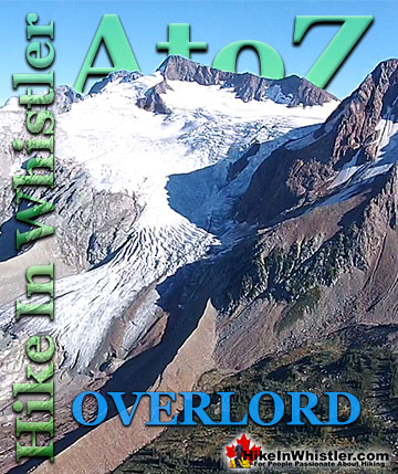
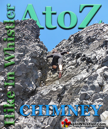
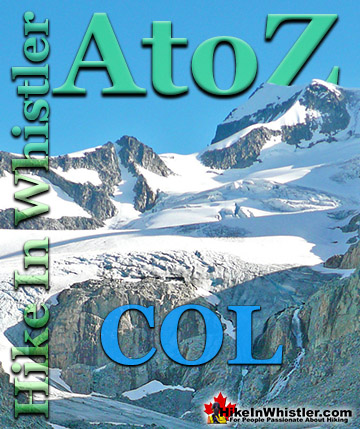

The Best Whistler & Garibaldi Park Hiking Trails!
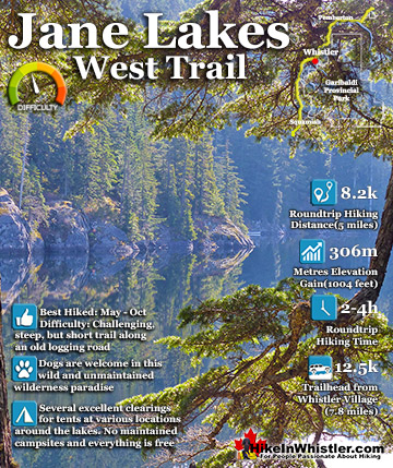
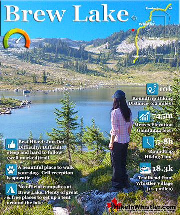
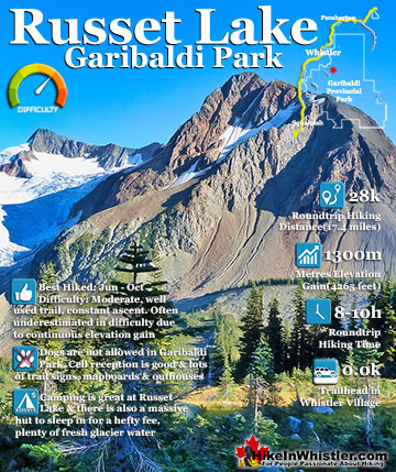
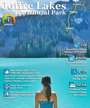
Whistler & Garibaldi Park Best Hiking by Month!


Explore BC Hiking Destinations!

Whistler Hiking Trails

Squamish Hiking Trails

Vancouver Hiking Trails

Clayoquot Hiking Trails
Victoria Hiking Trails

