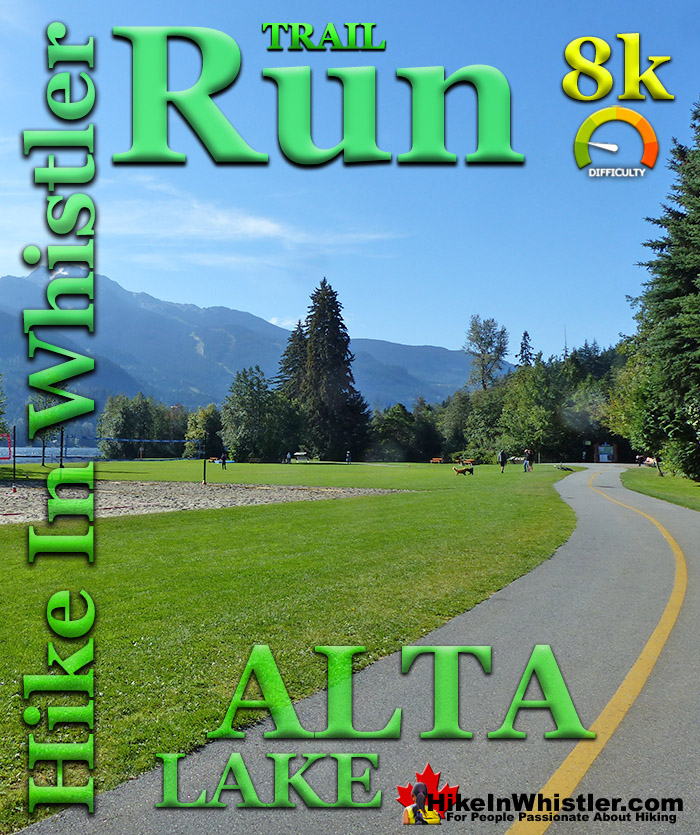
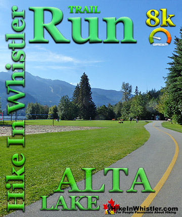
![]() The Alta Lake 8k is a beautiful 8 kilometre(5 mile) trail run in Whistler with a bunch of great things going for it. Beautiful views running along the Whistler Golf Course. Almost constant panoramic views of Whistler Mountain, Blackcomb Mountain and Wedge Mountain. A little old growth forest of massive Western redcedars, and more than half of the route is along the majestic shore of Alta Lake. This trail, like the Whistler Golf Course 5k, is accessible directly from Whistler Village, or from the convenient and free parking at the end of Lorimer Rd, just a 5 minute drive from anywhere in Whistler.
The Alta Lake 8k is a beautiful 8 kilometre(5 mile) trail run in Whistler with a bunch of great things going for it. Beautiful views running along the Whistler Golf Course. Almost constant panoramic views of Whistler Mountain, Blackcomb Mountain and Wedge Mountain. A little old growth forest of massive Western redcedars, and more than half of the route is along the majestic shore of Alta Lake. This trail, like the Whistler Golf Course 5k, is accessible directly from Whistler Village, or from the convenient and free parking at the end of Lorimer Rd, just a 5 minute drive from anywhere in Whistler.
Whistler & Garibaldi Hiking
![]() Alexander Falls
Alexander Falls ![]() Ancient Cedars
Ancient Cedars ![]() Black Tusk
Black Tusk ![]() Blackcomb Mountain
Blackcomb Mountain ![]() Brandywine Falls
Brandywine Falls ![]() Brandywine Meadows
Brandywine Meadows ![]() Brew Lake
Brew Lake ![]() Callaghan Lake
Callaghan Lake ![]() Cheakamus Lake
Cheakamus Lake ![]() Cheakamus River
Cheakamus River ![]() Cirque Lake
Cirque Lake ![]() Flank Trail
Flank Trail ![]() Garibaldi Lake
Garibaldi Lake ![]() Garibaldi Park
Garibaldi Park ![]() Helm Creek
Helm Creek ![]() Jane Lakes
Jane Lakes ![]() Joffre Lakes
Joffre Lakes ![]() Keyhole Hot Springs
Keyhole Hot Springs ![]() Logger’s Lake
Logger’s Lake ![]() Madeley Lake
Madeley Lake ![]() Meager Hot Springs
Meager Hot Springs ![]() Nairn Falls
Nairn Falls ![]() Newt Lake
Newt Lake ![]() Panorama Ridge
Panorama Ridge ![]() Parkhurst Ghost Town
Parkhurst Ghost Town ![]() Rainbow Falls
Rainbow Falls ![]() Rainbow Lake
Rainbow Lake ![]() Ring Lake
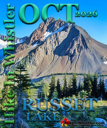
Ring Lake ![]() Russet Lake
Russet Lake ![]() Sea to Sky Trail
Sea to Sky Trail ![]() Skookumchuck Hot Springs
Skookumchuck Hot Springs ![]() Sloquet Hot Springs
Sloquet Hot Springs ![]() Sproatt East
Sproatt East ![]() Sproatt West
Sproatt West ![]() Taylor Meadows
Taylor Meadows ![]() Train Wreck
Train Wreck ![]() Wedgemount Lake
Wedgemount Lake ![]() Whistler Mountain
Whistler Mountain
![]() January
January ![]() February
February ![]() March
March ![]() April
April ![]() May
May ![]() June
June ![]() July
July ![]() August
August ![]() September
September ![]() October
October ![]() November
November ![]() December
December
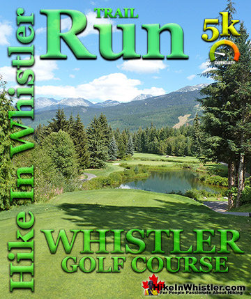
![]() Whistler Golf 5k
Whistler Golf 5k ![]() Blueberry Hill 6k
Blueberry Hill 6k ![]() Lost Lake 6k
Lost Lake 6k ![]() Alta Lake 8k
Alta Lake 8k ![]() Fitzsimmons 9k
Fitzsimmons 9k ![]() Alta Green Lost 15k
Alta Green Lost 15k
The trail run can be accessed by running from Whistler Village under the Sea to Sky Highway via the underpass near the Conference Centre and getting on the Valley Trail heading in either direction. If you are not staying in the Village, then you can drive to the free parking at the end of Lorimer Rd. From here you will see the excellent, Valley Trail signs directing you. The red line on the map below indicates the 8k route. This beautiful trail runs along or near Alta Lake for half of the 8k. The other half of the run goes through Rainbow Park or along the beautiful Whistler Golf Course. There is a short section of Alta Lake Road that you run along but even this has some amazing views over the lake. There are several hills on this route, but none too difficult or long. Unfortunately this run becomes very difficult in the winter as the snow is not plowed around the Rainbow Park to Lorimer Rd section. It can still be run, however, about 2k's are slogging through some rough and messy snow. The 5k route around the Whistler Golf Course is regularly plowed of snow in winter and is ideal.
Guides to the Best of Whistler
 Best Dog Friendly Hiking Trails
Whistler is very dog friendly and the number of wonderful hiking trails that your dog will love is huge. The massively varied hiking trails range from easy, short, close to Whistler Village to challenging, long and deep in the endless wilderness around Whistler. You can find dog friendly trails in and around Whistler Village that take you through deep, dark and magical forests. Or you can drive beyond Whistler Village and take your dog to spectacular alpine lakes. Some requiring little or no hiking, while others are found after hiking challenging and long trails. Many of these places are comparatively quiet and often you and your dog will have the the wilderness to yourselves. In and around Whistler Village you have Lost Lake with its spider web of trails... Continued here.
 Kid Friendly Whistler Hiking Trails
There are plenty of excellent, kid and family friendly hiking trails and destinations in and around Whistler. Kid and family friendly generally means an easy and somewhat short trail that a toddler can happily manage. Some of these trails are flat enough to be stroller friendly, such as Brandywine Falls, Whistler Mountain and Blackcomb Mountain. Others such as Logger’s Lake, Cheakamus River and Madeley Lake have short enough trails to reach them that you can manage with little kids that don't want to hike too far. Some of these hikes and walks are popular and close to Whistler Village, like Whistler Mountain, Blackcomb Mountain, Lost Lake Park, Rainbow Park and Meadow Park. Others are a beautiful, but far drive into the mountains and tricky to find... Continued here.
 Best Free Whistler Camping
Whistler is surrounded by an immense wilderness dotted with spectacular, hidden lakes and amazing places to set up a tent. Decades of logging activity has left a network of forest service roads that has opened easy access to these places. Some of these you can drive to and some you may need a 4x4 to comfortably get to. Some places to camp for free you can drive to, some require a short hike and others are fairly long hikes to reach. Beautiful Callaghan Valley is home to several incredible and free places to camp. Callaghan Lake has a great free drive-to campsite just steps from this spectacular alpine lake. If you have a canoe, you can paddle to the end of Callaghan Lake and hike the short, but steep trail up to Cirque Lake. This gorgeous lake is deep in the alpine wilderness... Continued here.
 No Car? No Problem! Whistler Trails
Whistler as a resort has a wonderful car-free core. The Village Stroll runs through the heart of Whistler Village and is entirely car free. If you are visiting Whistler or living here and you don't have a car, it's no problem. On foot or on a bike you can travel the extensive network of non-motorized trails. The Valley Trail snakes through Whistler Village and extends in several directions, all of which lead to beautiful parts of Whistler. The Sea to Sky Trail and the Lost Lake trails continue this massive, car-free network of trails running almost everywhere in Whistler. When it comes to many of the best hiking trails, getting to the trailheads on foot, by bike or public transit can be tricky at best or complicated and impractical at worst. Many trailheads are far from Whistler Village and... Continued here.

The Alta Lake 8k Run
If you are starting the Alta Lake 8k run from Whistler Village, you will want to exit the Village between Buffalo Bills and the Conference Centre, then run under the underpass under the Sea to Sky Highway. You will then come to the Whistler Golf Course parking lot and clubhouse with the Valley Trail branching both left and right. Taking the Valley Trail to the left you immediately enter a deep forest with the golf course on your right. The Valley Trail follows the edge of the golf course as it bends left and right as well as gradual ascents and descents. You consistently gain a slight bit of elevation as you reach one end of the golf course and emerge from the forest where the Valley Trail bends right for about 20 metres along the edge of Blueberry Drive. Here you will catch your first stunning view of Whistler Golf Course and mountains in the distance. Wedge Mountain, with its starkly wedge shape fills the sky in the distance, poking above Blackcomb Mountain.
Bears Love Whistler Golf Course


On a sunny day this spot will stop you for a moment to take in this wonderful view. Wedge Mountain is the highest mountain in the Garibaldi Ranges and Blackcomb Mountain lays to its right in the foreground. To the left are Parkhurst, Rethel and Cook, all mountains surrounding Wedgemount Lake. Wedgemount Lake is one of the most amazing hiking destinations in Whistler and Garibaldi Provincial Park. After taking in this beautiful view, cross Blueberry Drive and continue running down St. Anton Way along the Valley Trail that runs along the right side of the road. The Valley Trail bends left down Archibald Way, then right on Carleton Way, then left on Lakeside Road before reaching Lakeside Park. From here you follow the Valley Trail along, or close to Alta Lake all the way to Rainbow Park. You don't have to worry about losing your way as the Valley Trail will guide you. When you do come to a fork in the trail you will have an excellent direction signpost and often a mapboard. Lakeside Park is quite a nice and big park that is very popular in the summer. There are a couple wharves, concession stand and washrooms. As you run past the park you will see a small trail on the right. It leads to a beautiful viewpoint and further along a little log cabin. Definitely worth a quick look for the great view.
Beautiful Lakeside Park

Back on the Valley Trail you will be ascending up into the forest and then descending down to Wayside Park. Another cute park on Alta Lake, Wayside Park is known for its secluded feel, great swimming and for canoe and kayak rentals in the summer. After Wayside Park you reach the end of Alta Lake and turn right and hug the shore of the other side of Alta Lake. Almost immediately you will see Alta Lake Park on your right. Even if you are rushing through on your run, you should run through this cute park. It is only slightly longer than continuing on the Valley Trail and it takes you through a nice forest with two piers on either end and several old relics from the past. An ancient truck and tractor lay rusting in the forest along the path as well as some great art installations. The short, Alta Lake Park path continues to a fork in the trail. Right takes you immediately to the park's huge L-shaped pier and the left fork brings you back out to the Valley Trail.
Early Morning at Wayside Park


The Valley Trail turns sharply left and crosses the train tracks, then ascends up to Alta Lake Road. Turn right on Alta Lake Road and just run along the road for a kilometre before getting back on the Valley Trail in Rainbow Park. This kilometre long stretch of road is actually quite nice to run along as it ascends up to give you great views of Alta Lake and the background of mountains. There is a shortcut from Alta Lake Road into Rainbow Park just a couple hundred metres before the parking lot entrance. You will see it on the right as a wide trail into the trees. This trail zig-zags you down to Rainbow Park at the train track crossing. There are washrooms here as well as a water fountain. After you cross the train tracks and the bridge you can take a right to go to the lovely pier, or take a left and continue your run along the Valley Trail.


Leaving Rainbow Park you enter the forest and cross the River of Golden Dreams. A few hundred metres later you come to another Valley Trail junction at the end of Lorimer Road. This is where you have to turn right on the Valley Trail and head back to the Village via Whistler Golf Course. The Valley Trail connects in three directions here, so you want to make sure you head in the direction along Lorimer Road.

The Valley Trail splits after just a hundred metres along Lorimer Road, where Lorimer Road bends sharply left. Take the Valley Trail that runs straight into the forest, away from Lorimer Road. This is the Valley Trail that connects to Whistler Golf Course in just a couple minutes. When you come to the golf course the trail splits again as the trail runs around Whistler Golf Course. Taking the trail around the left side is the more direct route around the end of Whistler Golf Course and through a beautiful forest of huge Western redcedars. Impressively huge, this end of the golf course faces south and is where you will catch great views on a sunny day. Emerging from the cedar forest you slowly ascend toward where you started at the clubhouse parking lot.

More Whistler Running
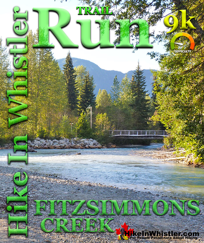
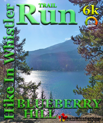
![]() There are plenty of great running trails in Whistler. The Whistler Golf Course 5k is one of the easiest and most convenient. The Blueberry Hill 6k follows part of the same route along Whistler Golf Course, as well as an interesting and challenging section that runs up and over Blueberry Hill. Though only a kilometre longer than the golf course route, the Blueberry Hill 6k has some steep uphill and downhill sections. Much more challenging and rewarding than the golf course run, it requires a bit more routefinding and a couple streets to navigate through. The Whistler Golf Course 5k is easy, relaxing and you don't have to think about where you are going as the route is quite clear. The Lost Lake 6k is similarly easy to follow and quite a bit of nice scenery. As with the Whistler Golf Course 5k and the Blueberry Hill 6k, the Lost Lake 6k starts right from Whistler Village. The trail takes you out and around Lost Lake and back to the Village through an amazingly serene and relaxing forest. The Alta Lake 8k is another beautiful running route that starts and finishes in Whistler Village at the Whistler Golf Course clubhouse. It takes you around Alta Lake, through several beautiful lakeside parks and hardly a minute goes by without a gorgeous mountain, lake or forest view. The Fitzsimmons 9k also begins in Whistler Village and takes you around one side of Lost Lake before continuing out to and across Fitzsimmons Creek, where you then run alongside the river back to where you started in Whistler Village. The Alta Green Lost 15k is a beautiful combination of parts of the previous trails. It takes you from Whistler Village, around Alta Lake along the Alta Lake 8k route. Instead of bending back to Whistler Village, you continue running north, along the River of Golden Dreams until you reach Green Lake. After you run across the amazingly scenic boardwalk bridge across Green Lake, you cross Fitzsimmons Creek and run along the far shore of Lost Lake and back to Whistler Village.
There are plenty of great running trails in Whistler. The Whistler Golf Course 5k is one of the easiest and most convenient. The Blueberry Hill 6k follows part of the same route along Whistler Golf Course, as well as an interesting and challenging section that runs up and over Blueberry Hill. Though only a kilometre longer than the golf course route, the Blueberry Hill 6k has some steep uphill and downhill sections. Much more challenging and rewarding than the golf course run, it requires a bit more routefinding and a couple streets to navigate through. The Whistler Golf Course 5k is easy, relaxing and you don't have to think about where you are going as the route is quite clear. The Lost Lake 6k is similarly easy to follow and quite a bit of nice scenery. As with the Whistler Golf Course 5k and the Blueberry Hill 6k, the Lost Lake 6k starts right from Whistler Village. The trail takes you out and around Lost Lake and back to the Village through an amazingly serene and relaxing forest. The Alta Lake 8k is another beautiful running route that starts and finishes in Whistler Village at the Whistler Golf Course clubhouse. It takes you around Alta Lake, through several beautiful lakeside parks and hardly a minute goes by without a gorgeous mountain, lake or forest view. The Fitzsimmons 9k also begins in Whistler Village and takes you around one side of Lost Lake before continuing out to and across Fitzsimmons Creek, where you then run alongside the river back to where you started in Whistler Village. The Alta Green Lost 15k is a beautiful combination of parts of the previous trails. It takes you from Whistler Village, around Alta Lake along the Alta Lake 8k route. Instead of bending back to Whistler Village, you continue running north, along the River of Golden Dreams until you reach Green Lake. After you run across the amazingly scenic boardwalk bridge across Green Lake, you cross Fitzsimmons Creek and run along the far shore of Lost Lake and back to Whistler Village.
Whistler's Best Running Trails!
Whistler & Garibaldi Park Best Hiking by Month!


Explore BC Hiking Destinations!

Whistler Hiking Trails

Squamish Hiking Trails

Vancouver Hiking Trails

Clayoquot Hiking Trails
Victoria Hiking Trails

