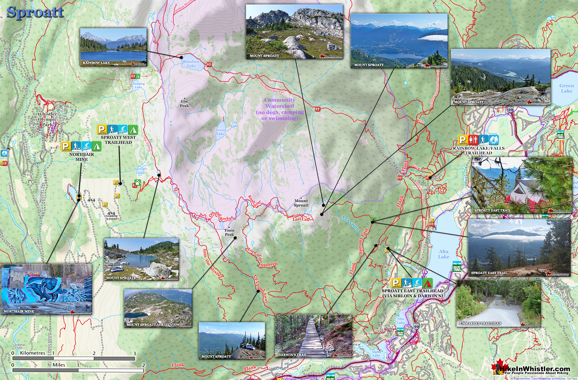
Mount Sproatt, or as it is known locally as just Sproatt, is one of the many towering mountains visible from Whistler Village. Above and beyond Alta Lake, directly across from Whistler Mountain and Blackcomb Mountain, you will see this quiet giant. Its unremarkable appearance hides the growing network of trails that stretch through some startlingly beautiful terrain.
Multiple trailheads & access points
Wild, hostile terrain rarely visited by humans
Connecting trails to Rainbow, Hanging & Madeley
No crowds & endless idyllic tarns to swim
Dozens of perfect spots for a tent
Vast terrain full of adventurous routes
Dog friendly, unlike most Whistler trails
Easy to get lost in the vast alpine
No grand turquoise lakes like Wedge
Need a 4x4 to get to the Callaghan trailhead
Next time you walk through Whistler Village and cross the pedestrian bridge(with Village Gate Boulevard below you), you will see Mount Sproatt in the distance. It is the rocky giant, abruptly steep on one end and gently sloping on the other. At its summit you may be able to make out the small weather recording structure. What you can't see from Whistler Village is the extraordinarily beautiful alpine paradise that lays beyond it. Lakes and tarns everywhere you look. Fields of alpine flowers and wonderfully mangled, yet strikingly beautiful forests of krummholz. Hostile looking fields of boulders and absurdly placed erratics the size of trucks. Beyond, of course, endless stunning view of distant, snowy mountains. From the towering elevation of much of the Sproatt trail network you look across or even down on distant mountains. Rainbow Mountain looks incredible from much of the trail. Four teeth-like, jagged grey peaks in a row that face you from Rainbow Mountain, just 5 kilometres away look enormous.
Sproatt West(Northair) Trail Map
A couple kilometres closer you spot Hanging Lake and the Lord of the Rings style valley that stretches 2 kilometres from its shores to the abrupt cliffs at your feet. Several times along the trail you see the clearly defined ski runs on Whistler Mountain and Blackcomb Mountain and once in a while you can spot Alta Lake and Whistler Village. Though a hive of snowmobile and ski/riding activity in the winter and spring, Sproatt is infrequently hiked in the summer.
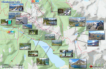
Cheakamus Lake is a wonderfully relaxing way to get in the wilderness easily and quickly from Whistler Village. The trail begins on the far side of Whistler Mountain, 8 ...
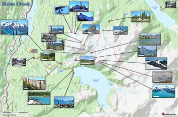
Helm Creek is a cute, meandering creek that winds its way from beyond Black Tusk, down the valley to the wonderful campground that takes its name. From the Helm Creek ...
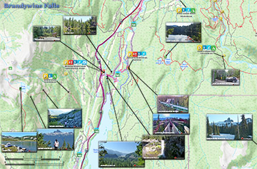
Brandywine Falls is one of the must see sights on the way to or from Whistler. The falls drop from a 70 metre(230 feet), unnaturally abrupt looking cliff to the valley below. ...
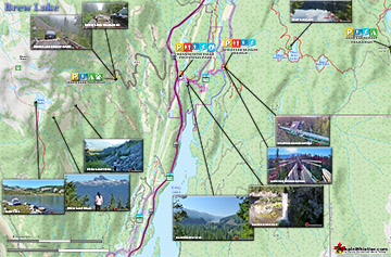
Brew Lake is beautiful mountain lake just a short drive south of Whistler and is relatively unknown and seldom hiked. Laying at the base of Mount Brew, Brew Lake lays in a ...
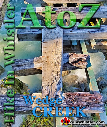
Wedge Creek cuts through the valley that separates Wedge Mountain and Blackcomb Mountain and empties into Green River near the north end of Green Lake. ...
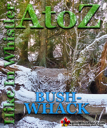
Bushwhack is a term often used in Canada and the United States to refer to hiking off-trail where no trail exists. Literally means 'bush' and 'whack'. To ...
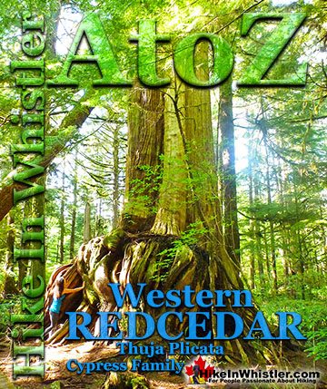
Western redcedar is a very large tree commonly found in the Pacific Northwest. Frequently growing up to 70 metres and with a trunk diameter of 7 metres, ...
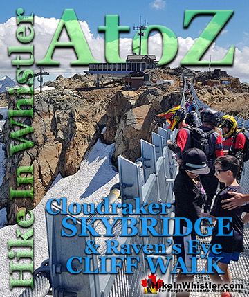
The Cloudraker Skybridge and the Raven’s Eye Cliff Walk are new additions to the summit of Whistler Mountain. The Cloudraker Skybridge stretches 130 ...
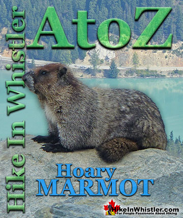
Hoary Marmots are the cute, pudgy, twenty plus pound ground squirrels that have evolved to live quite happily in the hostile alpine areas around Whistler. ...
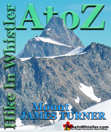
If you make it to the summit of Wedge Mountain you will notice off in the distance a beautifully symmetrical mountain that stands out among the rest. ...
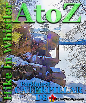
Along the shore of Green Lake, you will find a monstrous old Caterpillar tractor that dates from the 1930’s. Abandoned here in the 1950’s, it looks as if the ...
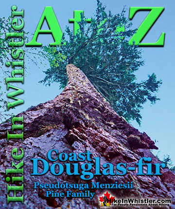
Coast Douglas-fir trees are medium to extremely large trees that you will encounter in Whistler and Garibaldi Park. They are the second tallest conifer ...
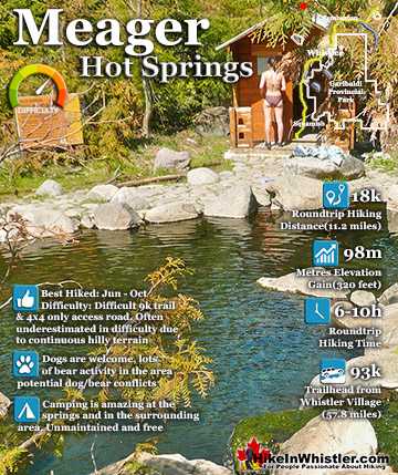
Meager Hot Springs(aka: Meager Creek Hot Springs) is located 93 kilometres northwest of Whistler, was beautifully developed into gorgeous pools, with a caretaker and usage charge. At its height of ...
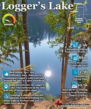
Logger's Lake is an amazing little lake hidden up in the deep forest above the more well known Cheakamus River. The lake, almost unbelievably exists in a long extinct volcano. However, as soon as you see ...
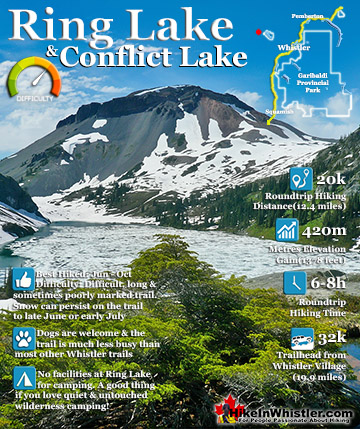
Ring Lake is a fantastically serene and wonderfully remote lake similar to Cirque Lake, but considerably farther to hike to reach it. The 10 kilometre(6.2 mile) hike takes you through a rarely hiked forest, ...
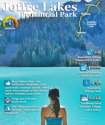
Joffre Lakes Provincial Park is a gorgeous park with extraordinarily coloured lakes, waterfalls, stunning mountain peaks and ominous glaciers pouring into the valley. Joffre Lakes is one of those incredible ...
 Multiple trailheads & access points
 Easy to get lost in the vast alpine