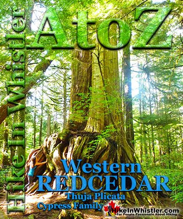
![]() Ancient Cedars is a nice, easy/moderate 2.6 kilometre(1.6 mile) hiking trail on the far side of Cougar Mountain, just 13.1 kilometres north of Whistler Village. A small, untouched grove of huge western redcedar hidden high up in the mountains. Often overlooked by hikers, certainly there are other groves of massive cedars found in other Whistler area hikes.
Ancient Cedars is a nice, easy/moderate 2.6 kilometre(1.6 mile) hiking trail on the far side of Cougar Mountain, just 13.1 kilometres north of Whistler Village. A small, untouched grove of huge western redcedar hidden high up in the mountains. Often overlooked by hikers, certainly there are other groves of massive cedars found in other Whistler area hikes.
 Easy trail to thousand year old cedars
- Remote feeling escape from civilisation
- A quiet hiking trail that is dog friendly!
- Serene backcountry, drive-in camping for free
- Lots of hidden & amazing tent sites
- Newt Lake is wild, hidden & serene
- Abandoned cabin at Showh Lakes
 Lots of mosquitoes in June to August
- ATV's tours in the area are noisy
- The access logging road is brutally potholed
If you hike the short 3 kilometre trail to Cheakamus Lake and you will marvel at the size, frequency and wonderful aroma of these massive and numerous giant cedars. The Wedgemount Lake trail also has some majestic cedars along the hike. You can even walk through an impressive grove of huge cedars on the Valley Trail at the north end of the Whistler Golf Club. None of them compare, however, to the giants at Ancient Cedars. They are extraordinarily huge and some are estimated to be a thousand years old. Most of these giants stretch toward the sky, but some lay along the forest floor giving you an even closer grasp of their size. If you bring kids along, they will disappear into the endless, natural playground. Ancient Cedars is great to visit in the spring and fall months as you rarely see people and are less likely to encounter mosquitoes. The problem is the trailhead is up a long way into the mountains and snow at this elevation persists until April and sometimes May. Snow, along with the steep access road make driving to the trailhead impossible for most cars until it disappears. Summer is great for seeing Ancient Cedars and Showh Lakes in particular. If you have a 4x4, you can drive right to the shores of Showh Lakes and crack a beer with little chance of humanity disturbing you. If you don't have a 4x4, you can make it to a short walk to the lakes and if you have some sort of inflatable boat or canoe, you will find yourself in paradise. Floating in a mirror under a blue sky, surrounded by deep and wild forest.
Finding Ancient Cedars
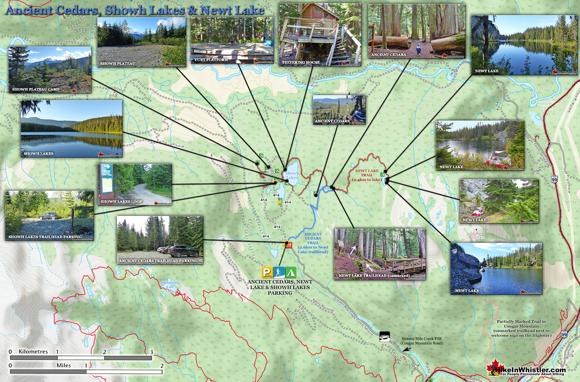
The trailhead to Ancient Cedars is just a short drive north of Whistler. Just past Green Lake on Highway 99, you turn left on Cougar Mountain Road and drive 4.5 kilometres up a bumpy logging road. As logging roads go its pretty bad with a lot of deep potholes. If you are driving a car you should be OK as long as you take it slow. The Ancient Cedars trail is well marked and well worn and only gradually uphill for the 2.6 kilometre hike. At the Ancient Cedars forest there is a short circle trail that takes you throughout the giants then leads you back to the main trail for the return journey. An unmarked trailhead to Newt Lake starts at the end of the Ancient Cedars trail. The Newt Lake trail is wild, overgrown and fairly steep, but surprisingly enjoyable. Lots of wild forest scenery and constantly changing topography. At the end of the wild Newt Lake trail is the beautifully wild Newt Lake. Relatively unknown, this lake is rarely visited and you will often have it all to yourself. Fantastic!

Ancient Cedars and Showh Lakes
Though Ancient Cedars is the main focus for visitors in the area, there are branching trails to two other beautiful areas, Newt Lake and Showh Lakes. Showh Lakes are just a few hundred metres from Ancient Cedars and trails and logging roads connect them. Partway along the trail to Ancient Cedars you will see a branching trail to Showh Lakes. There is another connecting trail extending from the Ancient Cedars grove as well, but it is hard to spot and quite overgrown. If you have a 4x4 you can drive the old logging road up to the lakes and branching roads extend in a few directions. The road is pretty bad, especially after the crossroads next to Showh Lakes, so its a good idea to park there and continue on foot to the lake or the various interesting areas overlooking the lakes.

At the north end of the larger of the two Showh Lakes you will find the remains of an old house and a derelict yurt platform. The area is quite beautiful and serene and the house is teetering over and hilarious to see. You can even climb the increasingly spiral stairs to the collapsing deck and into the old cabin.

Back across the larger of the two Showh Lakes a very nice hiking trail runs through the forest and along the south shore of the lake. The trail then enters the forest and connects to the Ancient Cedars trail.


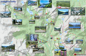
Ancient Cedars Newt Lake Map
The Ancient Cedars trail is a fairly relaxing, though constantly ascending trail up to the beautifully hidden forest. At just 2.6 kilometres, the hike is well under an hour from the trailhead to the loop trail through the ancient grove. At the far end of the loop an unmarked trail continues to a beautiful and very remote feeling lake. The Newt Lake trail from the end of the Ancient Cedars trail to Newt Lake is just 2.4 kilometres long, though much more challenging than the Ancient Cedars trail. It winds through the weather battered and mangled rainforest up towards Cougar Mountain. It is a constantly ascending and often very steep trail, though due to its short length most hikers should make it to the lake in just over an hour. Starting from the Ancient Cedars trailhead/parking it is about a 2 hour hike one way.

Guides to the Best of Whistler
 Best Dog Friendly Hiking Trails
Whistler is very dog friendly and the number of wonderful hiking trails that your dog will love is huge. The massively varied hiking trails range from easy, short, close to Whistler Village to challenging, long and deep in the endless wilderness around Whistler. You can find dog friendly trails in and around Whistler Village that take you through deep, dark and magical forests. Or you can drive beyond Whistler Village and take your dog to spectacular alpine lakes. Some requiring little or no hiking, while others are found after hiking challenging and long trails. Many of these places are comparatively quiet and often you and your dog will have the the wilderness to yourselves. In and around Whistler Village you have Lost Lake with its spider web of trails... Continued here.
 Best Free Whistler Camping
Whistler is surrounded by an immense wilderness dotted with spectacular, hidden lakes and amazing places to set up a tent. Decades of logging activity has left a network of forest service roads that has opened easy access to these places. Some of these you can drive to and some you may need a 4x4 to comfortably get to. Some places to camp for free you can drive to, some require a short hike and others are fairly long hikes to reach. Beautiful Callaghan Valley is home to several incredible and free places to camp. Callaghan Lake has a great free drive-to campsite just steps from this spectacular alpine lake. If you have a canoe, you can paddle to the end of Callaghan Lake and hike the short, but steep trail up to Cirque Lake. This gorgeous lake is deep in the alpine wilderness... Continued here.
 No Car? No Problem! Whistler Trails
Whistler as a resort has a wonderful car-free core. The Village Stroll runs through the heart of Whistler Village and is entirely car free. If you are visiting Whistler or living here and you don't have a car, it's no problem. On foot or on a bike you can travel the extensive network of non-motorized trails. The Valley Trail snakes through Whistler Village and extends in several directions, all of which lead to beautiful parts of Whistler. The Sea to Sky Trail and the Lost Lake trails continue this massive, car-free network of trails running almost everywhere in Whistler. When it comes to many of the best hiking trails, getting to the trailheads on foot, by bike or public transit can be tricky at best or complicated and impractical at worst. Many trailheads are far from Whistler Village and... Continued here.
 Kid Friendly Whistler Hiking Trails
There are plenty of excellent, kid and family friendly hiking trails and destinations in and around Whistler. Kid and family friendly generally means an easy and somewhat short trail that a toddler can happily manage. Some of these trails are flat enough to be stroller friendly, such as Brandywine Falls, Whistler Mountain and Blackcomb Mountain. Others such as Logger’s Lake, Cheakamus River and Madeley Lake have short enough trails to reach them that you can manage with little kids that don't want to hike too far. Some of these hikes and walks are popular and close to Whistler Village, like Whistler Mountain, Blackcomb Mountain, Lost Lake Park, Rainbow Park and Meadow Park. Others are a beautiful, but far drive into the mountains and tricky to find... Continued here.
 Whistler Train Wreck Murals
The colourful graffiti and murals that make Whistler Train Wreck the magical place it is today began appearing in 2011, when this hidden place was known by just a few Whistler locals. In the summer of 2011 several Whistler artists came here for "The Train Wreck Paint Jam" and transformed the mangled wreckage into a surreal art exhibit. The artists ranged from aspiring graffiti artists to professional artists like Kups. Remnants of one of his murals from 2011 is found inside the first boxcar you come to after crossing the bridge into Whistler Train Wreck. Several of the original murals were gorgeous. Brilliantly coloured and surreal in such an unusual, tranquil and hidden forest with seven mangled train boxcars scattered. Like some sort of haunting art gallery... Continued here.
More Whistler & Garibaldi Park Hiking Maps!
Russet Lake Maps
Cheakamus Lake Maps
Brew Lake Maps
Alexander Falls Maps

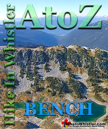
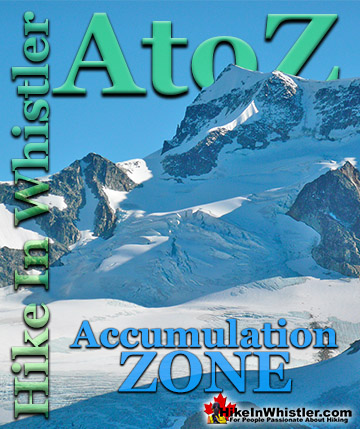
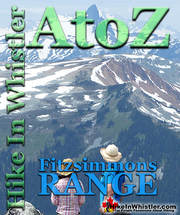
Whistler & Garibaldi Park Glossary A to Z

The Best Whistler & Garibaldi Park Hiking Trails!