HikeInWhistler.com

HikeInWhistler.com

Menu
  • Hike
      • Alexander Falls Provincial Park
      • Ancient Cedars & Showh Lakes
      • Black Tusk in Garibaldi Park
      • Blackcomb Mountain Hiking Trails
      • Brandywine Falls Provincial Park
      • Brandywine Meadows
      • Brew Lake & Mount Brew
      • Callaghan Lake Park
      • Cheakamus Lake in Garibaldi Park
      • Cheakamus River & Interpretive Forest
      • Cirque Lake in Callaghan Valley
      • Flank Trail (Rainbow-Sproatt)
      • Garibaldi Lake in Garibaldi Park
      • Helm Creek in Garibaldi Park
      • Jane Lakes West
      • Joffre Lakes Provincial Park
      • Keyhole Hot Springs
      • Logger's Lake
      • Madeley Lake & Hanging Lake
      • Meager Hot Springs
      • Nairn Falls Provincial Park
      • Newt Lake & Ancient Cedars
      • Panorama Ridge in Garibaldi Park
      • Parkhurst Ghost Town
      • Rainbow Falls
      • Rainbow Lake
      • Ring Lake & Conflict Lake
      • Russet Lake in Garibaldi Park
      • Sea to Sky Trail
      • Skookumchuck Hot Springs
      • Sloquet Hot Springs
      • Sproatt West(Northair) Trail
      • Sproatt East(Stonebridge) Trail
      • Train Wreck & Trash Trail
      • Taylor Meadows in Garibaldi Park
      • Wedgemount Lake in Garibaldi Park
      • Whistler Mountain Hiking Trails
  • Snow
      • Blueberry Trail Snowshoeing
      • Brandywine Falls Snowshoeing
      • Cheakamus River Snowshoeing
      • Elfin Lakes Snowshoeing
      • Flank Trail Snowshoeing
      • Joffre Lakes Snowshoeing
      • Nairn Falls Snowshoeing
      • Parkhurst Ghost Town Snowshoeing
      • Rainbow Falls Snowshoeing
      • Rainbow Lake Snowshoeing
      • Rainbow Park Snowshoeing
      • Sproatt East Snowshoeing
      • Taylor Meadows Snowshoeing
      • Train Wreck Snowshoeing
      • Wedgemount Lake Snowshoeing
  • Run
      • Whistler Golf Course 5k(3.1 Mile)
      • Blueberry Hill 6k(3.7 Mile)
      • Lost Lake 6k(3.7 Mile)
      • Alta Lake 8k(5 Mile)
      • Fitzsimmons Creek 9k(5.6 Mile)
      • Alta Green Lost 15k(9.3 Mile)
  • Best
      • Best Whistler Hiking by Month
          • Best by Month
      • Best Walk, Bike or Bus To Trails
      • Best Whistler Kid Friendly Trails
      • Best Whistler Dog Friendly Trails
      • Best Free Camping in Whistler
      • Best Sights Sea to Sky
      • Best Whistler Waterfalls
      • Best Whistler Aerial Views
      • Best Squamish Hiking Trails
      • Best Whistler Hiking Trails
      • Best Vancouver Hiking Trails
      • Best Whistler Snowshoeing
          • Best Whistler Snowshoe Trails
      • Best Whistler Running Trails
      • Best Whistler Hiking Gear Rentals
      • Best Whistler Parks & Beaches
  • AtoZ
      • Ablation Zone
      • Accumulation Zone
      • Adit Lakes
      • Aiguille
      • Alpine Zone
      • Arborlith or Lithophyte
      • Arête
      • A River Runs Through It
      • Armchair Glacier
      • The Barrier
      • Battleship Islands
      • Bears
      • Bench
      • Bergschrund or Schrund
      • Bivouac or Bivy
      • Blue Face House in Parkhurst
      • Bungee Bridge
      • Cairns & Inukshuks
      • Carter, Neal
      • Caterpillar D8
      • Caterpillar RD8
      • Chimney
      • Cirque or Cirque Lake
      • Cloudraker Skybridge
      • Coast Mountains
      • Col
      • Crevasse
      • Deadfall
      • Emerald Forest
      • Erratic or Glacier Erratic
      • The Fissile
      • Fitzsimmons Creek
      • Fitzsimmons Range
      • Fyles, Tom
      • Garibaldi Ranges
      • Garibaldi Volcanic Belt
      • Gemel or Inosculation
      • Glacier Window
      • Green Lake
      • Hoary Marmot
      • Krummholz
      • Moraine
      • Mount Garibaldi
      • Mount James Turner
      • Northair Mine
      • Nunatuk
      • Overlord Mountain & Glacier
      • Peak2Peak Gondola
      • Roundhouse Lodge
      • Rubble Creek
      • Spearhead Range
      • Tarn
      • The Table
      • Usnea or Old Man's Beard
      • Western Redcedar
  • Maps
      • Alexander Falls Maps
      • Ancient Cedars Maps
      • Black Tusk Maps
      • Blackcomb Mountain Maps
      • Brandywine Falls Maps
      • Brandywine Meadows Maps
      • Brew Lake Maps
      • Callaghan Lake Maps
      • Cheakamus Lake Maps
      • Cheakamus River Maps
      • Cirque Lake Maps
      • Garibaldi Lake Maps
      • Helm Creek Maps
      • Joffre Lakes Maps
      • Keyhole Hot Springs Maps
      • Logger's Lake Maps
      • Madeley Lake Maps
      • Meager Hot Springs Maps
      • Nairn Falls Maps
      • Panorama Ridge Maps
      • Parkhurst Ghost Town Maps
      • Rainbow Falls Maps
      • Rainbow Lake Maps
      • Ring Lake Maps
      • Russet Lake Maps
      • Skookumchuck Maps
      • Sloquet Hot Springs Maps
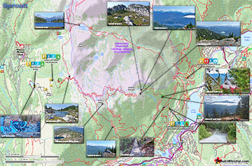
      • Sproatt Maps
      • Taylor Meadows Maps
      • Train Wreck Maps
      • Wedgemount Lake Maps
      • Whistler Mountain Maps
  • More
      • Whistler Hiking News & Blog
      • Live Whistler Webcams
      • Live Tofino Webcams
      • Live Vancouver Webcams
      • Garibaldi Provincial Park
      • Hike in Whistler Glossary

Black Tusk

Wedgemount Lake

Cirque Lake

Joffre Lakes

Whistler Train Wreck

Callaghan Lake

Brandywine Meadows

Black Tusk

Logger's Lake

Adit Lakes

Wedgemount Lake

Northair Mine

Newt Lake

Spectacular Whistler!

Whistler hiking is wonderful! Check out our Best Whistler Hiking by Month guides! WeRentGear.com rents tents, sleeping bags, sleeping pads, camp stoves, packs, complete kits and more!

Best Trails This Week!

Best This Week: Whistler Train Wreck and Parkhurst Ghost Town are easy, fun and dog friendly. Check out our July and August Whistler and Garibaldi Park guides here!

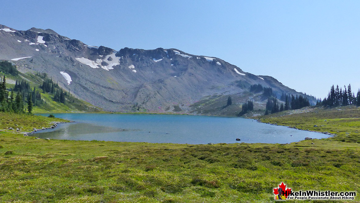
The Rainbow Trail is a convenient and popular trail near Whistler Village that takes you to Rainbow Lake as well as the Flank Trail, Rainbow Falls, Hanging Lake, Madeley Lake, Beverley Lake, Rainbow Mountain... and even Whistler Olympic Park if you are determined.  It is a consistently uphill and very beautiful trail with several water (bridge) crossings and waterfalls on the way to the picture-perfect lake. 

  • Quiet trail compared to other Whistler trails
  • Trails continue past the lake to other lakes
  • Stunning views of Blackcomb & Whistler mountains
  • Continuing trail/route to Rainbow Mountain
  • The alpine hiking options(eg: Sproatt) are incredible
  • The huge erratics at the lake are perfect for suntanning
  • No camping, fishing or swimming allowed
  • Trail is sometimes scenic, but often in deep forest
  • Tour companies often fly over spoiling the serenity
  • Dogs not allowed due to being Whistler's water source

There are a few views of the valley across to Whistler Mountain, Blackcomb Mountain, and Wedge Mountain.  Few views, though fantastic.  Rainbow Lake itself is in a gorgeous alpine valley with branching trails that extend further beyond the lake in at least three directions.  Along with the waterfalls, bridge crossings and valley views, the Rainbow Trail passes through deep forest with some impressively huge trees.  Plenty of birds can be heard and seen along the trail and though black bears frequent the area, they are infrequently spotted due to their migration down into the valley.  Cougars are also known to roam around this area, though also rarely spotted.  As recently as 2014 signs of cougar activity were identified on the Flank Trail near where it branches off from the Rainbow Trail.  The Rainbow Trail has a small side trail that takes you to Rainbow Falls. Not far from the trailhead, the small Rainbow Falls sign is easily missed.

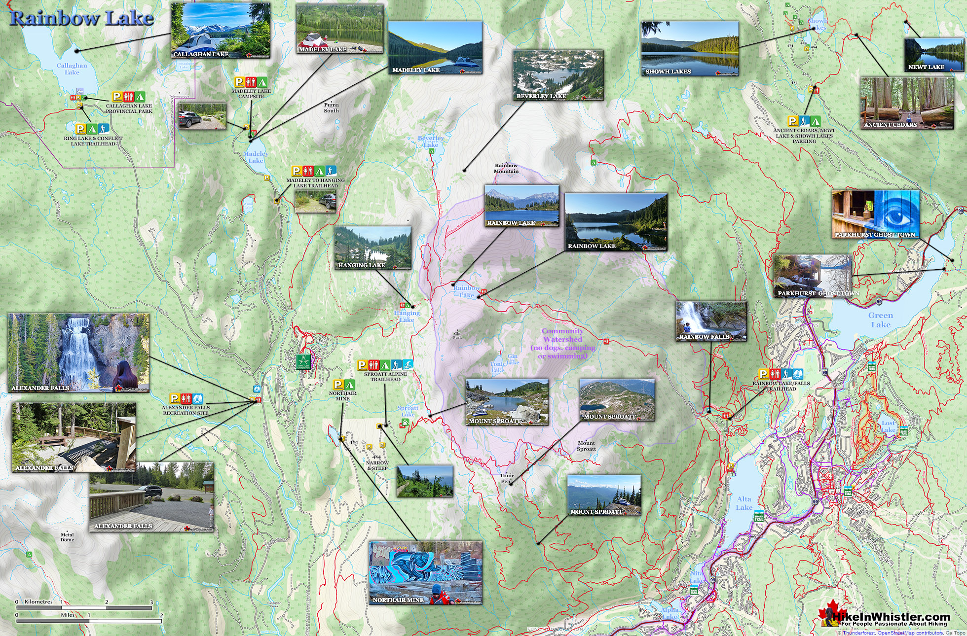
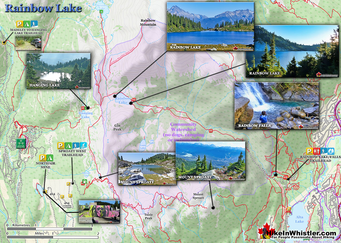
Rainbow Lake Hiking Trail Map

It is located about five minutes into the Rainbow Trail and your best bet to find it is to keep bearing right along the first couple trail branches. Don't worry about getting lost here though as all the trails reconnect further along the trail when you briefly exit the forest at the water treatment building. Unfortunately, Rainbow Lake is the water supply for Whistler, so you cannot swim, fish or camp near the lake. There is decent camping available nearby at Hanging Lake as well as Beverley Lake in the direction of Rainbow Mountain.

Rainbow Lake Map v12

Hanging Lake and Beverley Lake

Hanging Lake is a bit dark and swampy as compared to the spectacular camping at Beverley Lake which is a tough but rewarding hike beyond Rainbow Lake.  Beverley Lake is reached by following the trail toward Rainbow Mountain. About 40 minutes into this trail the trail markers will stop as it ascends up into an extensive boulder field towards Rainbow Mountain. To reach Beverley Lake, bear left of the route to Rainbow Mountain and follow the valley.  Beverley Lake is about an hours hike from Rainbow Lake. To get even further from the world, hike the partly marked trail to Beverley Lake. The first kilometre is well worn and easy to follow as this is also a somewhat popular trail to reach the summit of Rainbow Mountain. The Rainbow Mountain trail veers right and quickly ascends through massive boulders.  If you instead bear left and stay in the valley you will reach this fantastically remote lake.  You will be a bit disheartened, however, when you arrive at the lake and see a picnic table.  It's very out of place, evidently put there by some helicopter tour company.  Other than the weird picnic table there are no signs of humanity, and no restrictions on camping as you have at Rainbow Lake.

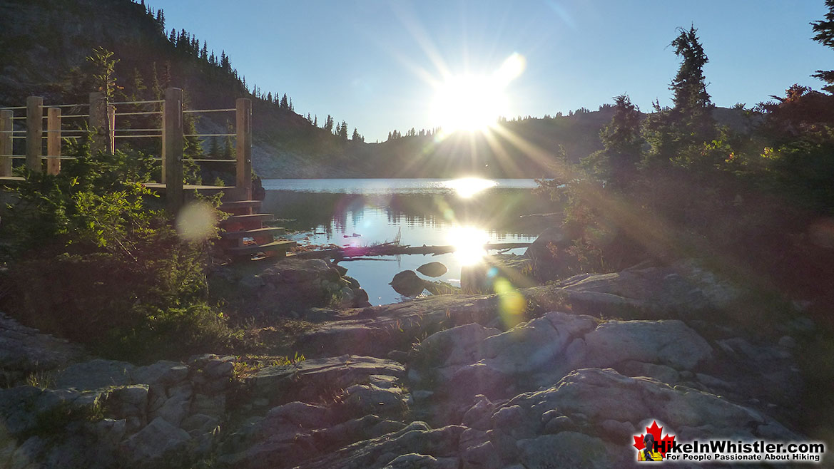
Rainbow Lake Hike in Whistler

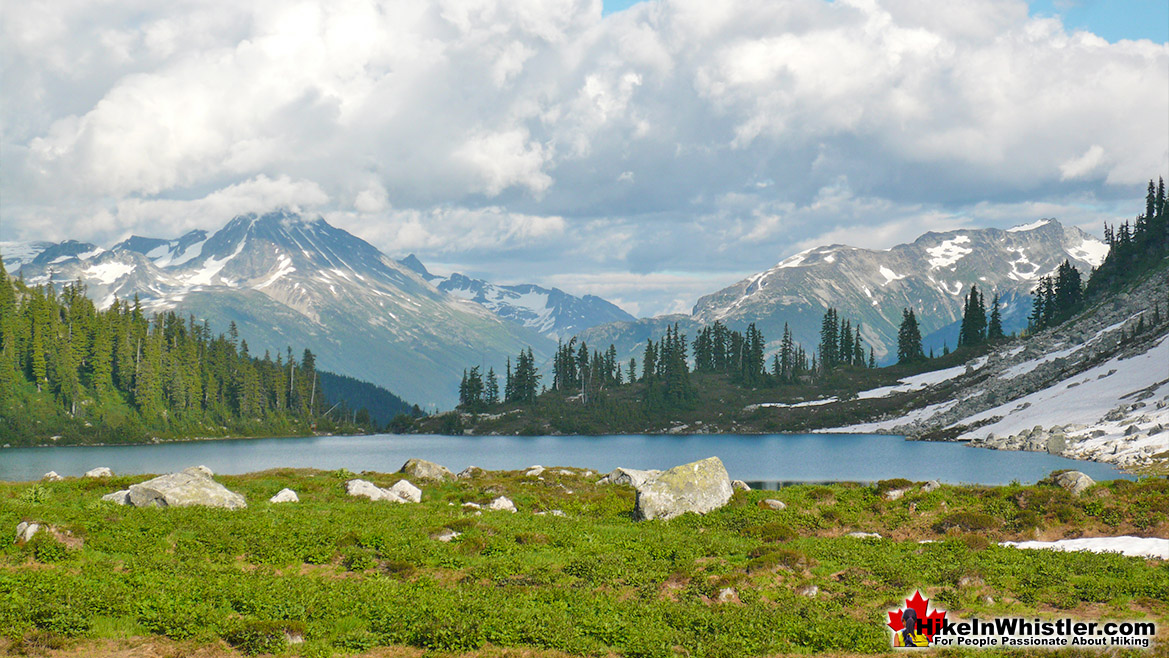
Rainbow Lake - Hike in Whistler

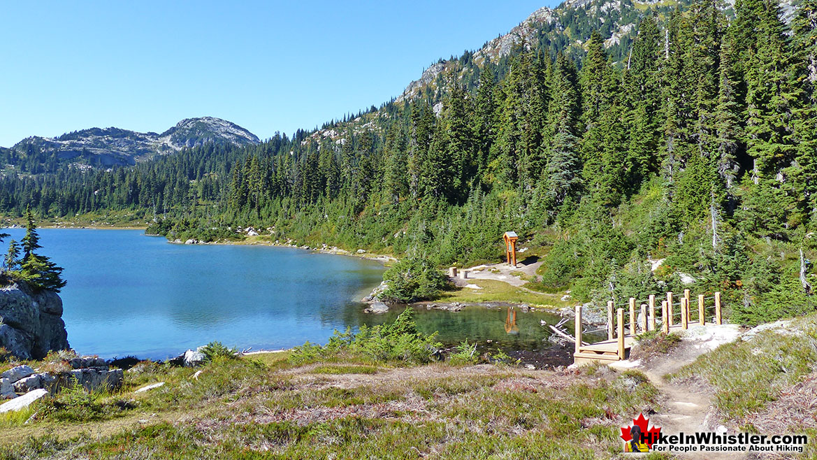
Rainbow Lake Hike in Whistler

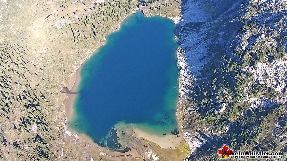
Rainbow Lake Aerial View

Rainbow Lake - Hike in Whistler

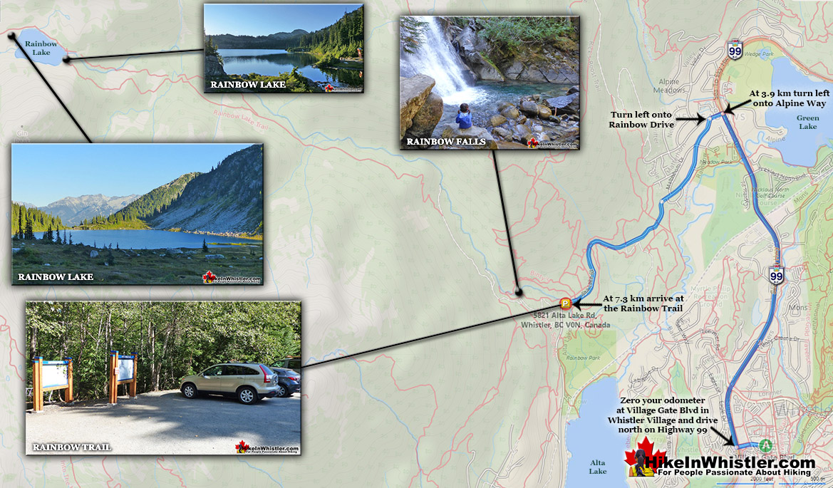
Rainbow Trail Directions Map

More Rainbow Lake Hiking Info...

More Whistler & Garibaldi Park Hiking Maps!
Keyhole Hot Springs Maps

Keyhole Hot Springs (aka Pebble Creek Hot Springs) is located 100 kilometres from Whistler(Village Gate Blvd). Though most of the 100 kilometres is on logging roads, it is ...
Read more

Helm Creek Maps

Helm Creek is a cute, meandering creek that winds its way from beyond Black Tusk, down the valley to the wonderful campground that takes its name. From the Helm Creek ...
Read more

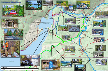
Parkhurst Ghost Town Maps

Whistler has an absurd number of wonderful and free hiking trails and Parkhurst Ghost Town certainly ranks as one of the most unusual, exotic and interesting. Parkhurst was a little ...
Read more

Nairn Falls Maps

Nairn Falls is a wonderful, crashing and chaotic waterfall that surrounds you from the deluxe viewing platform that allows you to safely watch it from above.  The beautiful, green ...
Read more
More Whistler Hiking Trail Maps

West Coast Trail Best Sights

Whistler & Garibaldi Park Glossary A to Z
Crevasse: is a split or crack in the glacier surface, often with near vertical walls.  Crevasses form out of the constant movement of a glacier over ...
Read more
The second Caterpillar tractor in Parkhurst Ghost Town is considerably harder to find despite being just a few metres from the hulking Caterpillar at the shore ...
Read more
Cairns, inukshuks or inuksuks are a pile or arrangement of rocks used to indicate a route, landmark or a summit.  The word cairn originates from the ...
Read more
Cornice: a wind deposited wave of snow on a ridge, often overhanging a steep slope or cliff.  They are the result of snow building up on the crest of a ...
Read more
The Peak 2 Peak Gondola connects Whistler Mountain and Blackcomb Mountain at a dizzying height of 436 metres(1427 feet).  It runs all winter and in the ...
Read more
Whistler, the surrounding mountains, and Garibaldi Provincial Park are home to two types of bears.  Black bears and grizzly bears.  Black bears are ...
Read more
Bench: a flat section in steep terrain.  Characteristically narrow, flat or gently sloping with steep or vertical slopes on either side.  A bench can be ...
Read more
Parkhurst Ridge is an incredible place for a lot of reasons.  Of course, the view is spectacular with Green Lake's absurdly vivid green coloured water.  ...
Read more
More Hike in Whistler Glossary

Free Camping Gear Delivery to Garibaldi Park

The Best Whistler & Garibaldi Park Hiking Trails!
Whistler has an absurd number of wonderful and free hiking trails and Parkhurst Ghost Town certainly ranks as the most unusual and interesting. Parkhurst was a little logging town perched on the edge of Green ...
Read more
The Rainbow Trail is a convenient and popular trail near Whistler Village that takes you to Rainbow Lake as well as the Rainbow-Sproatt Flank Trail, Rainbow Falls, Hanging Lake, Madeley Lake, Beverley ...
Read more
Hiking and biking trails are so abundant in Whistler that many go unnoticed, neglected or taken for granted.  The Flank Trail is one of these.  Most people in Whistler don't even know about it, but the ones ...
Read more
Madeley Lake is a gorgeous mountain lake located high up in the Callaghan Valley just a short drive past Alexander Falls.  From Whistler Village it takes about 50 minutes to drive the 27.4 kilometres to get ...
Read more
More Whistler Hiking Trails & Maps

HikeInWhistler.com HikeInWhistler.com © 2025
  • Contact Us: [email protected]