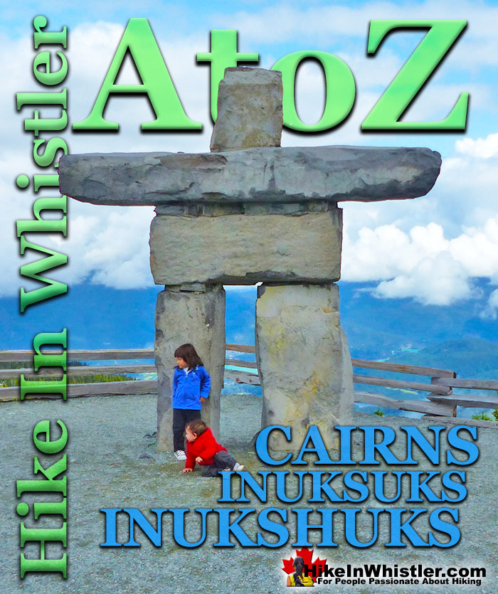
Cairns, inukshuks or inuksuks are a pile or arrangement of rocks used to indicate a route, landmark or a summit. The word cairn originates from the Scottish Gaelic word carn. A cairn or inukshuk can be either large and elaborate or as simple as a small pile of rocks. To be effective a cairn marking a trail has to just be noticeable and obviously man-made. In the alpine areas around Whistler, above the treeline, cairns are the main method of marking a route.
In the spring and fall when snow covers alpine trails, cairns mark many routes. An inukshuk(also spelled inuksuk) is the name for a cairn used by peoples of the Arctic region of North America. Both spelling versions are pronounced nearly as they are spelled. So inukshuk is pronounced inook-shuk, and inuksuk with inook-suk. Though an inukshuk can take many forms similar to a cairn, it is usually represented by large rocks formed into a human shape. The word inukshuk literally translates from two separate Inuit words, inuk "person" and suk "substitute". The 2010 Winter Olympics in Vancouver and Whistler used the inukshuk for the logo of the games. Today you will find several giant rock inukshuks in Vancouver and Whistler at various places. In Whistler there is an impressive inukshuk, several metres high a the peak of Whistler Mountain. Another huge inukshuk sits overlooking Whistler Valley at the Roundhouse next to the Umbrella Bar. The first inukshuk that most visitors to Whistler see is the huge one on Village Gate Boulevard.
Inukshuk Near the Roundhouse
Whistler Peak Inukshuk
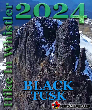
Inukshuk and Distant Black Tusk
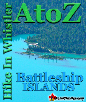
Battleship Islands Cairns, Garibaldi Lake
More Whistler & Garibaldi Park Hiking A to Z!
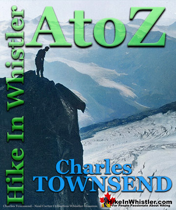
Charles Townsend moved from England to Vancouver in the early 1920's where he met Neal Carter while studying at UBC. They worked together in the summer of 1923 as ...
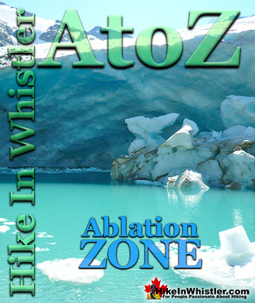
Ablation Zone: the lower altitude region of a glacier where there is a net loss of ice mass due to melting, sublimation, evaporation, ice calving or ...
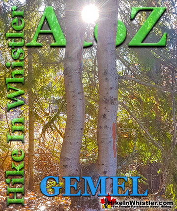
Inosculation is the technical name for two or more trees that have fused together into a single bizarre looking tree. They are colloquially known as ...
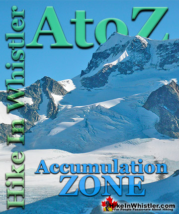
Accumulation Zone: the area where snow accumulations exceeds melt, located above the firn line. Snowfall accumulates faster than melting, evaporation and ...
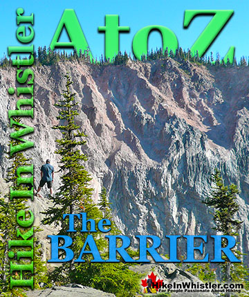
The Barrier formed as a result of huge lava flows from Clinker Peak on the west shoulder of Mount Price during the last ice age. About thirteen thousand ...
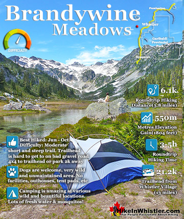
Brandywine Meadows is a nice, relatively short hike to a massive flower filled valley high up in Callaghan Valley. Located 40 minutes south of Whistler, this tough and sometimes muddy trail gains a huge 550 ...
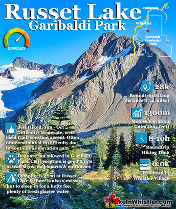
Russet Lake is a surreal little paradise that lays at the base of The Fissile, in Garibaldi Provincial Park. The Fissile is the strikingly bronze mountain visible from Whistler Village. From the Village ...
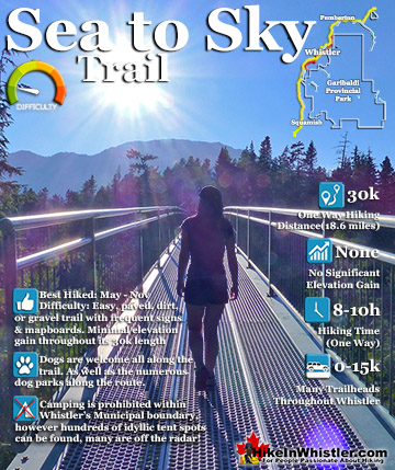
The Sea to Sky Trail is a 180 kilometre multi-use trail that runs from Squamish to D'Arcy. The trail is still under construction in many parts, however, the amazing route through Whistler is finally in ...
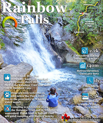
The short, winding, and ever-changing hiking trail to Rainbow Falls is the same as the much more popular trailhead for Rainbow Lake. The trailhead is marked as the Rainbow Trail, and the trail quickly ...
April in Whistler is a wonderful time of year. The winter deep freeze ends and T-shirt weather erupts. The village comes alive with overflowing patios and ...
May is an extraordinarily beautiful time of year in Whistler. The days are longer and warmer and a great lull in between seasons happens. Whistler is fairly ...
June is a pretty amazing month to hike in Whistler and Garibaldi Park. The average low and high temperatures in Whistler range from 9c to 21c(48f/70f). ...
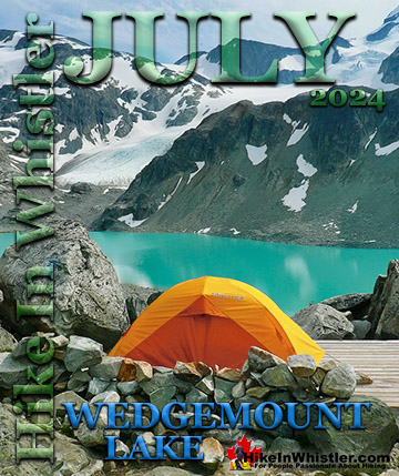
July is a wonderful time to hike in Whistler and Garibaldi Provincial Park. The weather is beautiful and the snow on high elevation hiking trails is long ...
Hiking in Whistler is spectacular and wonderfully varied. Looking at a map of Whistler you see an extraordinary spider web of hiking trails that are unbelievably numerous. Easy trails, moderate trails and challenging hiking trails are all available. Another marvellous ...
Squamish is located in the midst of a staggering array of amazing hiking trails. Garibaldi Provincial Park sprawls alongside Squamish and up and beyond Whistler. Tantalus Provincial Park lays across the valley to the west and the wonderfully remote Callaghan Valley ...
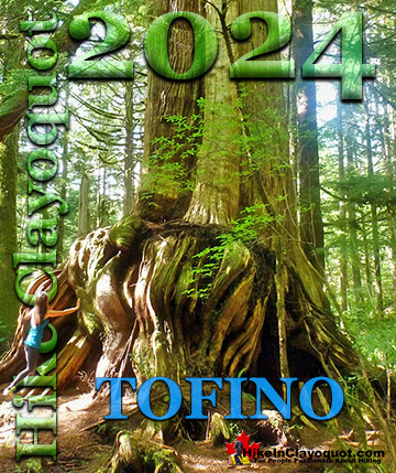
Clayoquot Sound has a staggering array of hiking trails within it. Between Tofino and Ucluelet, Pacific Rim Park has several wilderness and beach trails, each one radically different from the last. The islands in the area are often Provincial parks on their own with ...
Victoria has a seemingly endless number of amazing hiking trails. Most take you to wild and beautiful Pacific Ocean views and others take you to tranquil lakes in beautiful BC Coastal Rainforest wilderness. Regional Parks and Provincial Parks are everywhere you turn in ...
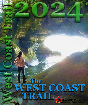
The West Coast Trail was created after decades of brutal and costly shipwrecks occurred along the West Coast of Vancouver Island. One shipwreck in particular was so horrific, tragic and unbelievable that it forced the creation of a trail along the coast, which ...